Bottovo

Bottovo
Bottovo
(Village)
Administration
Pays Drapeau de Slovaquie Slovaquie
Région Région de Banská Bystrica
District District de Rimavská Sobota
Code postal 98041
Plaque minéralogique RS
Starosta (maire) Andrea Baláková ( Indépendant )

Mandat: 2013

Démographie
Population 214 hab. (31.12.2007)
Densité 19,8 hab./km2
Géographie
Coordonnées 48° 19′ 00″ Nord
       20° 09′ 00″ Est
/ 48.316667, 20.15
Altitude 196 m
Superficie 1 078,8919 ha = 10,788919 km²
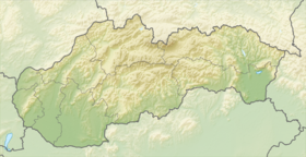
Localisation en Slovaquie
Voir la carte physique
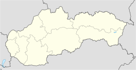
Localisation de la ville
Bottovo
Voir la carte administrative
Localisation de la ville
Bottovo
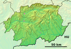
Localisation dans la région de Banská Bystrica
Internet
Site de la commune http://www.bottovo.ou.sk
Sources
Resultat des élections
http://www.e-obce.sk [1]
http://www.statistics.sk [2]
http://www.slovakregion.sk/ [3]


Bottovo (hongrois : Bottovó)[4] est un village de Slovaquie situé dans la région de Banská Bystrica.

Histoire

La première mention écrite du village date de 1926[2].

La localité fut annexée par la Hongrie après le premier arbitrage de Vienne le 2 novembre 1938. En 1938, on comptait 0 habitants. Elle faisait partie du district de Rimavská Sobota (hongrois : Rimaszombati járás). Durant la période 1938 - 1945, le nom hongrois Bottovo était d'usage[5]. À la libération, la commune a été réintégrée dans la Tchécoslovaquie reconstituée.

Notes et références

  1. (sk) e-obce.sk. Consulté le 28 janvier 2010
  2. a et b (sk) (en) Mestská a obecná štatistika SR. Consulté le 28 janvier 2010
  3. (sk) Slovak region. Consulté le 28 janvier 2010
  4. http://slovnik.juls.savba.sk/?d=obce
  5. Osudy slovenských Židov


Wikimedia Foundation. 2010.

Contenu soumis à la licence CC-BY-SA. Source : Article Bottovo de Wikipédia en français (auteurs)

Игры ⚽ Нужно сделать НИР?

Regardez d'autres dictionnaires:

  • Bottovo — is a village and municipality in the Rimavská Sobota District of the Banská Bystrica Region of Slovakia. External links*http://www.statistics.sk/mosmis/eng/run.html *http://www.e obce.sk/obec/bottovo/bottovo.html …   Wikipedia

  • Liste der Städte und Gemeinden in der Slowakei/A-G — Übersicht A bis G Teil 1 A bis G Teil 2 H bis Ľ Teil 3 M bis R Teil 4 S bis Ž Übersicht A B C Č D Ď E F G A …   Deutsch Wikipedia

  • Liste der Städte und Gemeinden in der Slowakei Teil 1 — Übersicht A bis G Teil 1 A bis G Teil 2 H bis Ľ Teil 3 M bis R Teil 4 S bis Ž Übersicht A B C Č D Ď E F G A …   Deutsch Wikipedia

  • Banská Bystrica Region — Geobox | Region name = Banská Bystrica other name = category = Region image caption = image caption = symbol = symbol type = Coat of arms etymology = official name = motto = nickname = country = Slovakia country state = region = district =… …   Wikipedia

  • Rimavská Sobota District —   District   Country Slovakia Re …   Wikipedia

  • Čerenčany — Rimavska Sobota District in the Banská Bystrica region Čerenčany (earlier Cšerencšány, is a village and municipality in the Rimavská Sobota District of the Banská Bystrica Region of southern Slovakia. During the past years village recorded… …   Wikipedia

  • Čierny Potok — Rimavska Sobota District in the Banská Bystrica region Čierny Potok is a village and municipality in the Rimavská Sobota District of the Banská Bystrica Region of southern Slovakia. History It arose in 1955 by separation from Hodejov. During… …   Wikipedia

  • Číž — Ciz redirects here. For the footballer, see Diego Ciz. Coordinates: 48°19′N 20°17′E / 48.317°N 20.283°E / 48.317; 20.28 …   Wikipedia

  • Dolné Zahorany — Rimavska Sobota District in the Banská Bystrica region Dolné Zahorany (earlier Maďarské Záhorany; Hungarian: Hegymeg, earlier Magyarhegymeg) is a village and municipality in the Rimavská Sobota District of the Banská Bystrica Region of Slovakia.… …   Wikipedia

  • Dražice, Rimavská Sobota District — Rimavska Sobota District in the Banská Bystrica region Dražice (Hungarian: Perjése, before 1938 Perjesse) is a village and municipality in the Rimavská Sobota District of the Banská Bystrica Region of Slovakia …   Wikipedia

Share the article and excerpts

Direct link
Do a right-click on the link above
and select “Copy Link”