Abranovce
- Abranovce
-
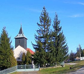
Abranovce (hongrois : Ábrány) est un village de Slovaquie situé dans la région de Prešov.
Histoire
Première mention écrite du village en 1320.
Notes et références
Catégories :
- Village de Slovaquie
- Village et ville du district de Prešov
Wikimedia Foundation.
2010.
Contenu soumis à la licence CC-BY-SA. Source : Article Abranovce de Wikipédia en français (auteurs)
Regardez d'autres dictionnaires:
Abranovce — is a village and municipality in Prešov District in the Prešov Region of eastern Slovakia.In historical recordswhich|date=June 2008 the village was first mentioned in 1320.The municipality lies at an altitude of 492 metres and covers an area of 9 … Wikipedia
Ján Hirka — Wappen von Ján Hirka, griechisch katholischen Administrator (1969–1989) und Bischof von Prešov (1989–2002) Ján Hirka (* 16. November 1923 in Abranovce, Kreis Presov) war von 1989 bis 2002 griechisch katholischer Bischof von Prešov. Leben und… … Deutsch Wikipedia
Prešov Region — Geobox | Region name = Prešov category = Region image caption = image caption = symbol = symbol type = etymology = official name = motto = nickname = country = Slovakia country state = region = district = commune = municipality = border = part… … Wikipedia
Prešov District — District Country Slovakia Re … Wikipedia
Veľký Šariš — Coordinates: 49°02′18″N 21°11′30″E / 49.03833°N 21.19167°E / 49.03833; 21.19167 … Wikipedia
List of municipalities and towns in Slovakia — Slovakia This is a comprehensive list of municipalities and towns in Slovakia. For lists of towns and municipalities sorted by Regions see the individual articles on Regions. For an outdated list of towns only in Slovakia see also List of towns… … Wikipedia
Červenica — Location of Prešov District in the Prešov Region. Červenica (Hungarian: Vörösvágás) is a village and municipality in Prešov District in the Prešov Region of eastern Slovakia … Wikipedia
Demjata — Location of Prešov District in the Prešov Region. Demjata (Hungarian: Deméte) is a village and municipality in Prešov District in the Prešov Region of eastern Slovakia. History In … Wikipedia
Drienov — Location of Prešov District in the Prešov Region. Drienov (Hungarian: Somos) is a village and municipality in Prešov District in the Prešov Region of eastern Slovakia. History In … Wikipedia
Drienovská Nová Ves — Location of Prešov District in the Prešov Region. Drienovská Nová Ves (Hungarian: Somosújfalu) is a village and municipality in Prešov District in the Prešov Region of eastern Slovakia. History … Wikipedia
 Slovaquie
 Abranovce


