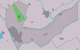
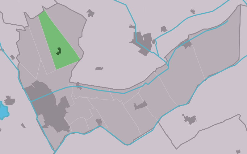
Tjalleberd
Contenu soumis à la licence CC-BY-SA. Source : Article Tjalleberd de Wikipédia en français (auteurs)
Regardez d'autres dictionnaires:
Tjalleberd — Infobox Settlement official name = Tjalleberd mapsize = 280px subdivision type = Country subdivision name = flagicon|Netherlands Netherlands subdivision type1 = Province subdivision name1 = flagicon|Friesland Friesland settlement type = Village… … Wikipedia
Tsjalbert — Tjalleberd 52°59′52″N 5°56′37″E / 52.99778, 5.94361 … Wikipédia en Français
Anthony Winkler Prins — (Voorst, 30 or 31 January 1817 ndash; Voorburg, 4 January 1908) was a Dutch writer. He is remembered mostly for being chief editor of the Winkler Prins encyclopedia.Besides being an encyclopedist, Winkler Prins (a double surname) was a… … Wikipedia
Aengwirden — Ancienne commune des Pays Bas Histoire Administration Pays Pays Bas … Wikipédia en Français
Heerenveen — Infobox Settlement official name = Heerenveen image seal size = 70px mapsize = 280px subdivision type = Country subdivision name = Netherlands subdivision type1 = Province subdivision name1 = Friesland area footnotes = (2006) area total km2 = 140 … Wikipedia
List of places in the Netherlands — This is an alphabetical list of places (cities, towns, villages) in the Netherlands. Lists per province can be found at:* List of towns in Groningen * List of towns in Friesland * List of towns in Drente * List of towns in Overijssel * List of… … Wikipedia
Aengwirden — is a former municipality in the Dutch province of Friesland. It covered the area around the village of Tjalleberd. It existed until July 1, 1934.The area of the former municipality is now a part of the municipality of Heerenveen.External links*… … Wikipedia
A7 motorway (Netherlands) — Location of the A7 motorway in the Netherlands. The A7 motorway is a motorway in the Netherlands connecting Zaandam, via the Afsluitdijk, Sneek and Groningen to the German border near Bad Nieuweschans. The entire road is part of the European… … Wikipedia
Autosnelweg A7 — Rijksweg A7/N7 Länge: 236 km Ans … Deutsch Wikipedia
Heerenveen — Gemeinde Heerenveen Flagge Wappen Provinz … Deutsch Wikipedia
 Pays-Bas