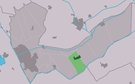
Nieuwehorne
Contenu soumis à la licence CC-BY-SA. Source : Article Nieuwehorne de Wikipédia en français (auteurs)
Regardez d'autres dictionnaires:
Nieuwehorne — Village Country … Wikipedia
Nieuwehorne — Original name in latin Nieuwehorne Name in other language Nieuwehorne, Nijehorne, Nijhoarne State code NL Continent/City Europe/Amsterdam longitude 52.95113 latitude 6.06342 altitude 2 Population 1472 Date 2012 01 17 … Cities with a population over 1000 database
Nijhoarne — Nieuwehorne 52°57′1″N 6°3′20″E / 52.95028, 6.05556 … Wikipédia en Français
Heerenveen — Infobox Settlement official name = Heerenveen image seal size = 70px mapsize = 280px subdivision type = Country subdivision name = Netherlands subdivision type1 = Province subdivision name1 = Friesland area footnotes = (2006) area total km2 = 140 … Wikipedia
List of places in the Netherlands — This is an alphabetical list of places (cities, towns, villages) in the Netherlands. Lists per province can be found at:* List of towns in Groningen * List of towns in Friesland * List of towns in Drente * List of towns in Overijssel * List of… … Wikipedia
Heerenveen — Gemeinde Heerenveen Flagge Wappen Provinz … Deutsch Wikipedia
Aldehoarne — Oudehorne 52°57′45″N 6°4′50″E / 52.9625, 6.08056 … Wikipédia en Français
Aldskoat — Oudeschoot 52°56′5″N 5°57′17″E / 52.93472, 5.95472 … Wikipédia en Français
Bontebok (Frise) — 52°57′47″N 6°1′32″E / 52.96306, 6.02556 … Wikipédia en Français
De Knijpe — De Knipe 52°58′7″N 5°58′16″E / 52.96861, 5.97111 … Wikipédia en Français
 Pays-Bas