South Bend (Indiana)
Contenu soumis à la licence CC-BY-SA. Source : Article South Bend (Indiana) de Wikipédia en français (auteurs)
Regardez d'autres dictionnaires:
South Bend, Indiana — South Bend Flagge Lage in Indiana … Deutsch Wikipedia
South Bend (Indiana) — South Bend Lage in Indiana … Deutsch Wikipedia
South Bend (Indiana) — South Bend (en inglés Curva del Sur) es una ciudad de los Estados Unidos (Indiana), en el SE de Chicago, en la ribera del río Saint Joseph. Cuenta con 105.511 hab. South Bend Ciudad de los Estados Unidos … Wikipedia Español
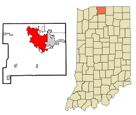
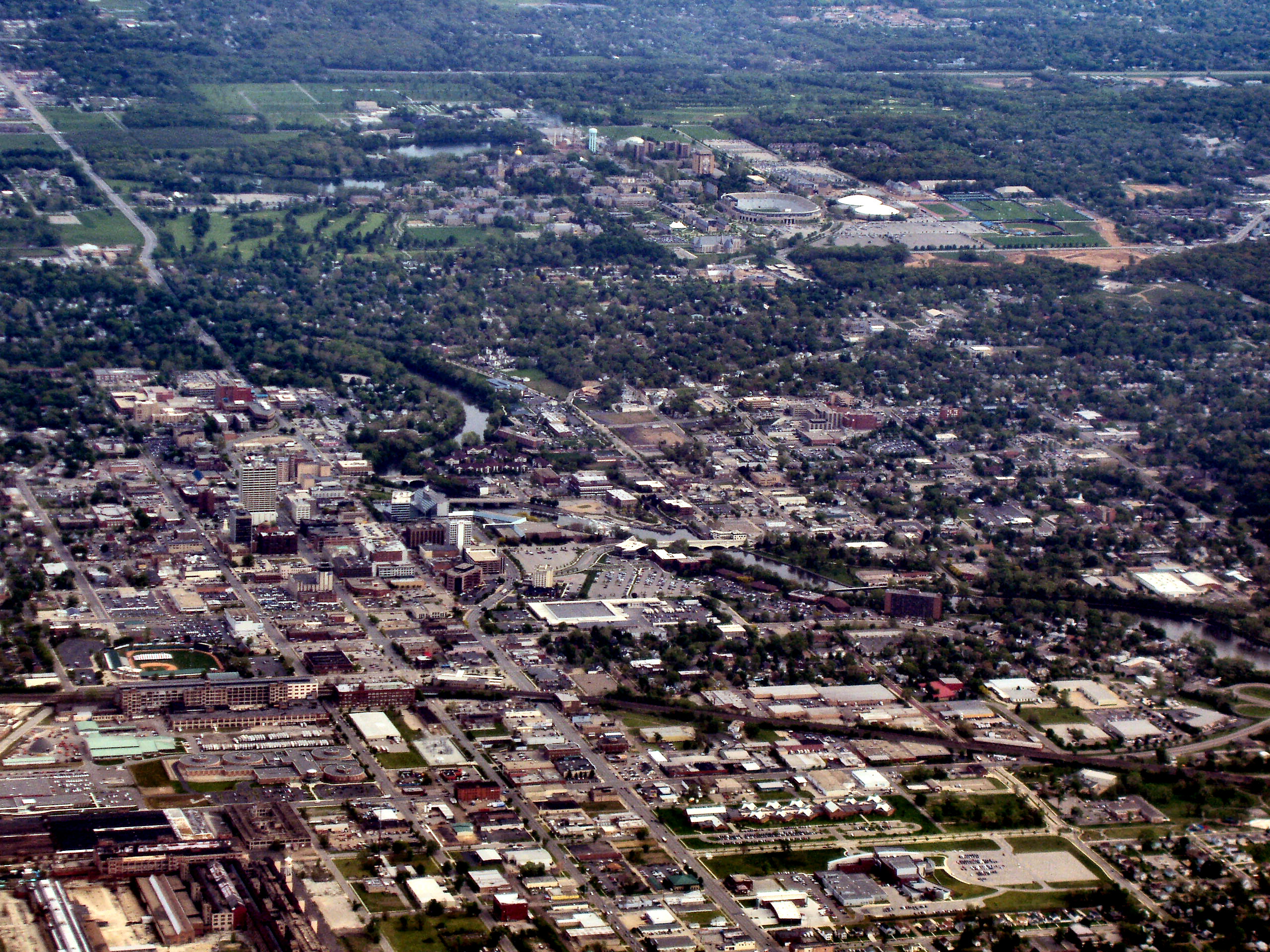
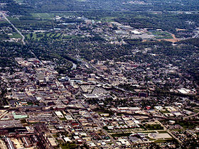
South Bend, Indiana — Infobox Settlement official name = City of South Bend, Indiana nicknames = settlement type = City imagesize = 250px image caption = South Bend from above image mapsize = 250x200px map caption = Location in the state of Indiana mapsize1 = map… … Wikipedia
John Adams High School (South Bend, Indiana) — John Adams High School (often referred to locally simply as Adams) is a public secondary school in South BendLocationThe campus is located in the River Park community on the East Side of South Bend, Indiana.Its address is 808 South Twyckenham… … Wikipedia
St. Joseph's High School (South Bend, Indiana) — Infobox School2 | name = Saint Joseph s High School established = 1953 motto = type = Private, Catholic head name = Principal head = Susan Richter head name2 = Assistant Principal head2 = Marty Harshman; Marilyn Gibbs city = South Bend state =… … Wikipedia
Washington High School (South Bend, Indiana) — Infobox Secondary school name = Washington High School established = 1960 city = South Bend state = Indiana country = USA campus = Urban type = Public secondary principal = George McCullough grades = 9–12 mascot = Panther colors = Green and White … Wikipedia
Education in South Bend, Indiana — Higher Education= South Bend, Indiana is home to a wide variety of higher educational facilities including several full universities, as well as community and technical colleges.Primary and Secondary Education Public Schools Public schools in… … Wikipedia
Union Station (South Bend, Indiana) — Infobox Station name=Union Station type= image size=300 image caption=Exterior of Union Station address=South Bend, Indiana coordinates= line= other= structure=Art Deco architecture platform= 3 depth= levels= tracks=5 parking= bicycle= baggage… … Wikipedia
South Bend Regional Airport — IATA: SBN – ICAO: KSBN – FAA L … Wikipedia
 États-Unis
 Indiana