Sandgate
- Sandgate
-
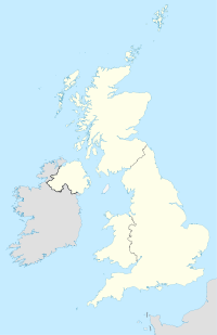
Sandgate est un village anglais du comté du Kent, district du Shepway, situé près de Folkestone en face de Boulogne-sur-Mer dans le sud-est de l'Angleterre. C'est une station balnéaire réputée de la côte du Kent. Ne doit pas être confondu avec la commune française de Sangatte située dans le département du Pas-de-Calais.
Sandgate a été un urban district de 1894 à 1934 après avoir été intégré dans la paroisse de Cheriton. Le village a ensuite été intégré à Folkestone de 1934 à 2004. Depuis 2004, le village a recouvré son statut de Paroisse civile. Il accueille le château de Sandget, un des Device Forts, cette série de forteresses construite sur l'ordre d'Henri VIII pour se prémunir d'un invasion franco-espagnole.
Le célèbre écrivain britannique Herbert George Wells a habité dans la Spade House[1].
La chanson de Morcheeba The Sea a été écrite à propos d'un populaire bar de plage, le Bar Vasa.
Jumelage
Sandgate est jumelée avec :
Notes et références
Liens externes
Catégories : - Village du Kent
- Station balnéaire du Royaume-Uni
Wikimedia Foundation.
2010.
Contenu soumis à la licence CC-BY-SA. Source : Article Sandgate de Wikipédia en français (auteurs)
Regardez d'autres dictionnaires:
Sandgate — Castle Sandgate ist ein Ort in der Grafschaft Kent, England. Der Ort hat etwa 3800 Einwohner und gehört verwaltungstechnisch zu Folkestone. Er liegt direkt an der Ärmelkanalküste. Wegen der strategischen Lage direkt am Kanal in der Nähe zu… … Deutsch Wikipedia
Sandgate — can be:*Sandgate, Kent *Sandgate Castle *Sandgate, Queensland *Sandgate, New South Wales, a suburb of Newcastle, New South Wales *Sandgate, Vermont … Wikipedia
Sandgate — (spr. ßändgĕt), Seebad in der engl. Grafschaft Kent, dicht bei Folkestone, mit einem festen Schloß aus der Zeit Heinrichs VIII., Soldatenheim (1881) und (1901) 2023 Einw … Meyers Großes Konversations-Lexikon
Sandgate — Original name in latin Sandgate Name in other language State code AU Continent/City Australia/Brisbane longitude 27.32198 latitude 153.06951 altitude 4 Population 4911 Date 2011 08 26 … Cities with a population over 1000 database
Sandgate Football Club — are an Australian rules club which played it s home games in the Brisbane suburb of Taigum. They were nicknamed both the Hawks and Sea Hawks and their club colours were bottle green and red.The Sandgate club is known as a cornerstone of the… … Wikipedia
Sandgate railway station, New South Wales — Sandgate is a railway station on the Hunter line section of the Main North railway line, north of Newcastle, New South Wales, Australia.It serves the suburb of Sandgate, and once had a branch line which served Sandgate Cemetery. However, trains… … Wikipedia
Sandgate Castle — [http://en.wikipedia.org/wiki/ ] (coord|51|04|24|N|1|08|56|E|) was one of Henry VIII s Device Forts. Built in 1539 near Sandgate, Kent, its exposed location has led to much damage by storm tides. Converted to a Martello Tower in the early 1800s,… … Wikipedia
Sandgate Primary School — is found in Sandgate and is located between the Folkestone School for Girls (FSG) and Eversley College. The old school building is located in the village on Sandgate Road. The modern building lies on Coolinge Lane and has extensive recreational… … Wikipedia
Sandgate, Queensland — Infobox Australian Place | type = suburb name = Sandgate city = Brisbane state = qld caption = Sandgate Post Office. lga = Brisbane City Council, Deagon Ward postcode = 4017 pop = 6126 (2004) [ [http://www.abs.gov.au/AUSSTATS/abs@.nsf/Latestproduc… … Wikipedia
Sandgate, Kent — infobox UK place country = England static static image caption=Sandgate Castle latitude= 51.074 longitude=1.1454 official name=Sandgate population = shire district= Shepway shire county = Kent region= South East England constituency westminster=… … Wikipedia
 Angleterre
