Queanbeyan
- Queanbeyan
-
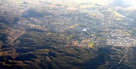
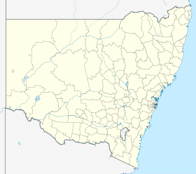
Queanbeyan (36 331 habitants) est une ville ("city") de Nouvelle-Galles du Sud en Australie. Située à 10 kilomètres de Canberra, la capitale fédérale de l'Australie, c'est la ville la plus proche de la capitale ce qui lui permet la plus forte croissance des villes de Nouvelle Galles du Sud.
Géographie
Cette ville est située sur la Queanbeyan River dont le cours est entravé par le barrage de Googong Dam, à 5 kilomètres de Queanbeyan, ce qui permet d'alimenter en eau les villes de Canberra et Queanbeyan.
Galerie
 |
Cliquez sur une vignette pour l’agrandir |
Personnalités
Notes et références
Wikimedia Foundation.
2010.
Contenu soumis à la licence CC-BY-SA. Source : Article Queanbeyan de Wikipédia en français (auteurs)
Regardez d'autres dictionnaires:
Queanbeyan — Luftaufnahme von Queanbeyan Staat … Deutsch Wikipedia
Queanbeyan — /ˈkwinbiən/ (say kweenbeeuhn) noun a city in NSW, just east of Canberra; agriculture; building industry. Queanbeyan is in territory traditionally inhabited by the Ngunnawal people. The area was explored by Charles Throsby Smith and his party in… …
Queanbeyan — ▪ New South Wales, Australia city, southeastern New South Wales, Australia. It lies along the Queanbeyan River, just southeast of the Australian Capital Territory (Canberra). It originated in 1828 as a holding called Queen Bean, a name… … Universalium
Queanbeyan — Original name in latin Queanbeyan Name in other language Kuinbejan, Queanbeyan, Куинбеян State code AU Continent/City Australia/Sydney longitude 35.35493 latitude 149.232 altitude 581 Population 40661 Date 2013 06 25 … Cities with a population over 1000 database
Queanbeyan — Admin ASC 2 Code Orig. name Queanbeyan Country and Admin Code AU.02.16470 AU … World countries Adminstrative division ASC I-II
Queanbeyan River — Googong StauseeVorlage:Infobox Fluss/KARTE fehlt DatenVorlage:Infobox Fluss/GKZ fehlt … Deutsch Wikipedia
Queanbeyan railway station, New South Wales — Queanbeyan is a railway station located on the border of Queanbeyan, New South Wales and Oaks Estate, Australian Capital Territory, Australia on CountryLink s Canberra Line. The station has a single platform capable of accommodating approximately … Wikipedia
Queanbeyan High School — is a New South Wales Government School situated in a large service centre just beyond the limits of the Australian Capital Territory. Queanbeyan is a city of 28,000 people located on the Queanbeyan River 291 km south west of Sydney via Tarago and … Wikipedia
Queanbeyan, New South Wales — Infobox Australian Place | type = city name = Queanbeyan state = nsw caption = Queanbeyan photographed from the air. The Ridgeway is in the right foreground, Jerrabobmerra in the top left. pop = 36,331 (2004) poprank = 37th density = 210 est =… … Wikipedia
Queanbeyan River — The Queanbeyan River joins the Molonglo River at Oaks Estate just within the Australian Capital Territory. The headwaters of the Queanbeyan River are approximately 70 kilometres east southeast of Queanbeyan near the village of Jerangle. The major … Wikipedia
 Pour les articles homonymes, voir Queanbeyan (homonymie).
 Queanbeyan vu du ciel
 Australie


