Jipsingboermussel

Jipsingboermussel

53°1′34″N 7°6′42″E / 53.02611, 7.11167

Jipsingboermussel
Administration
Pays Drapeau : Pays-Bas Pays-Bas
Province Groningue
Commune Vlagtwedde
Géographie
Population 400 (avec Zandberg) hab. (2006)
Autres informations
Code postal 9563 (Ter Apelkanaal)
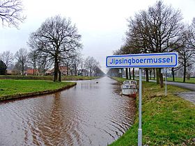
Localisation de Jipsingboermussel dans la commune de Vlagtwedde

Jipsingboermussel est un hameau qui fait partie de la commune de Vlagtwedde, situé dans la province néerlandaise de Groningue. Le 1er janvier 2006, le hameau comptait 400 habitants, y compris la partie groningoise de Zandberg.

Jipsingboermussel est situé sur le Ter Apelkanaal.


Wikimedia Foundation. 2010.

Contenu soumis à la licence CC-BY-SA. Source : Article Jipsingboermussel de Wikipédia en français (auteurs)

Игры ⚽ Нужен реферат?

Regardez d'autres dictionnaires:

  • Vlagtwedde — Héraldique …   Wikipédia en Français

  • Vlagtwedde — Infobox Settlement official name = Vlagtwedde mapsize = 280px subdivision type = Country subdivision name = Netherlands subdivision type1 = Province subdivision name1 = Groningen area footnotes = (2006) area total km2 = 170.51 area land km2 = 167 …   Wikipedia

  • List of places in the Netherlands — This is an alphabetical list of places (cities, towns, villages) in the Netherlands. Lists per province can be found at:* List of towns in Groningen * List of towns in Friesland * List of towns in Drente * List of towns in Overijssel * List of… …   Wikipedia

  • Agodorp — 52°52′N 7°5′E / 52.867, 7.083 Agodorp …   Wikipédia en Français

  • Barnflair — 52°51′5″N 7°4′54″E / 52.85139, 7.08167 …   Wikipédia en Français

  • Bourtange — 53° 00′ 24″ N 7° 11′ 30″ E / 53.0067, 7.19167 …   Wikipédia en Français

  • Jipsingboertange — 53°1′34″N 7°6′42″E / 53.02611, 7.11167 …   Wikipédia en Français

  • Jipsinghuizen — 52°58′37″N 7°8′59″E / 52.97694, 7.14972 …   Wikipédia en Français

  • Lauderzwarteveen — 52° 55′ 31″ N 7° 06′ 16″ E / 52.9253, 7.10444 …   Wikipédia en Français

  • Munnekemoer — 52° 50′ 38″ N 7° 04′ 57″ E / 52.84388889, 7.0825 …   Wikipédia en Français

Share the article and excerpts

Direct link
Do a right-click on the link above
and select “Copy Link”