- Allegheny County
-
Comté d'Allegheny
Comté d’Allegheny
(Allegheny County)
Administration Pays  États-Unis
État  Pennsylvanie
Chef-lieu Pittsburgh Fondation 1788 Caractéristiques Superficie Totale 1 929 km² Terre 1 891 km² Eau 38 km² (1,97 %) Population Totale (recens. 2000) 1 281 666 hab. Densité 677,77 hab./km² Le comté d'Allegheny est un comté du Commonwealth de Pennsylvanie aux États-Unis. Le siège du comté est la ville de Pittsburgh.
Sommaire
Géographie
Le comté est connu pour les trois rivières qui le parcourent et se rejoignent dans la ville de Pittsburgh : l'Allegheny, le Monongahela et l'Ohio. Une autre rivière, la rivière Youghiogheny rejoint la rivière Monongahela à McKeesport. Selon le bureau du recensement des États-Unis, le comté a un total de 1 929 km² pour 1 891 km² de terre et 38 km² d'eau.
Comtés voisins
- Comté de Butler (nord)
- Comté d'Armstrong (nord est)
- Comté de Westmoreland (esr)
- Comté de Washington (sud ouest)
- Comté de Beaver (nord ouest)
Les villes
Les principales villes du comté sont les villes de Clairton, Duquesne, McKeesport et Pittsburgh.
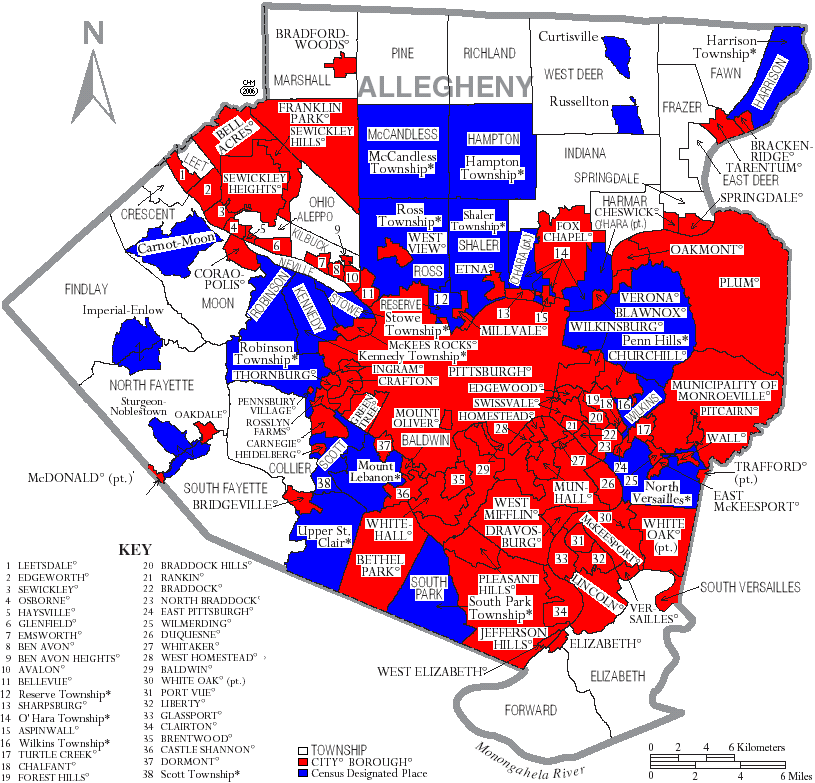
 Carte du comté, townships et municipalités
Population
Selon le recensement de 2000 du Bureau du recensement des États-Unis d'Amérique, il y a 1 281 666 habitants dans le comté, 537 150 ménages et 332 495 familles. Sa densité de population est de 678 hab/km². 84,33 % de la population s'est identifié comme blanche, 12,41 % afro-américaine, 0,12 % amérindienne, 1,69 % d'origine asiatique, 0,03 % originaire des îles du Pacifique, 0,34 % d'un autre groupe ethnique, 1,07 % de deux ou plus groupes ethniques. 0,87 % de la population est hispanique (notion qui ne préjuge d'aucun groupe ethnique). 20 % étaient d'origine allemande, 15 % italienne, 12,7 % irlandaise, 7,5 % polonaise et 5,1 % anglaise. 93,5 % avaient l'anglais, 1,3 % l'espagnol, pour langues maternelle.
Parmi les 537 150 foyers, 26,4 % comptaient un ou des enfants de moins de 18 ans, 46,1 % étaient des couples mariés vivant ensemble, 12,4 % avaient un chef de famille féminin sans mari, et 38,1 % étaient des foyers non familiaux. 32,7 % des foyers étaient constitués d'un individu vivant seul et 13,2 % d'un individu seul de 65 ou plus. Le nombre moyen de personnes par foyer était de 2,31 et la famille moyenne comptait 2,96 membres. 21,9 % des habitants avaient moins de 18 ans, 8,5 % entre 18 et 24 ans, 28,3 % de 25 à 44 ans, 23,4 % de 45 à 64 ans et 17,8 % 65 ans ou plus. L'âge moyen était de 40 ans.
Éducation
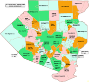 Carte des districts scolaires
Districts scolaires publics
- Allegheny Valley School District
- Avonworth School District
- Baldwin-Whitehall School District
- Bethel Park School District
- Brentwood Borough School District
- Carlynton School District
- Chartiers Valley School District
- Clairton City School District
- Cornell School District
- Deer Lakes School District
- Duquesne City School District
- East Allegheny School District
- Elizabeth Forward School District
- Fort Cherry School District (en partie)
- Fox Chapel Area School District
- Gateway School District
- Hampton Township School District
- Highlands School District
- Keystone Oaks High School
- McKeesport Area High School
- Montour School District
- Moon Area School District
- Mt. Lebanon School District
- North Allegheny School District
- North Hills School District
- Northgate School District
- Penn Hills School District
- Penn-Trafford School District (en partie)
- Pine-Richland School District
- Pittsburgh Public Schools|Pittsburgh School District
- Plum Borough School District
- Quaker Valley School District
- Riverview School District
- Shaler Area School District
- South Allegheny School District
- South Fayette Township School District
- South Park School District
- Steel Valley School District
- Sto-Rox School District
- Upper St. Clair High School
- West Allegheny School District
- West Jefferson Hills School District
- West Mifflin Area School District
- Wilkinsburg High School
- Woodland Hills School District
Lycées privés
- Bishop Canevin High School
- Central Catholic High School
- Mount Alvernia High School
- North Catholic High School
- Oakland Catholic High School
- Our Lady of the Sacred Heart High School
- Serra Catholic High School
- Seton-La Salle Catholic High School
- Sewickley Academy Senior School
- Shady Side Academy Senior School
- St. Joseph High School
Transports
Le Comté d'Allegheny possède un aéroport (code AITA : AGC).
Voir aussi
 Portail des États-Unis
Catégorie : Comté de Pennsylvanie


Wikimedia Foundation. 2010.