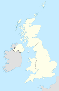
Folkingham
Contenu soumis à la licence CC-BY-SA. Source : Article Folkingham de Wikipédia en français (auteurs)
Regardez d'autres dictionnaires:
Folkingham — infobox UK place country = England latitude = 52.88725 longitude = 0.40596 map type=Lincolnshire official name = Folkingham population = 1,000 shire district= South Kesteven shire county = Lincolnshire region = East Midlands constituency… … Wikipedia
RAF Folkingham — Infobox Military Structure name= Royal Air Force Station Folkingham USAAF Station 484 location= Located Near Folkingham, Lincolnshire, England coordinates=coord|52|51|34.34|N|000|26|45.22|W|region:GB type:airport|display=inline,title caption=… … Wikipedia
82nd Airborne Division (United States) — Infobox Military Unit unit name=82nd Airborne Division caption=82nd Airborne Division shoulder sleeve insignia nickname= All American America s Guard of Honor motto= ALL THE WAY! themesong= The All American Soldier colors= march= ceremonial chief … Wikipedia
South Kesteven — Infobox UK district name = South Kesteven District status = District region = East Midlands admincounty = Lincolnshire area = Ranked 31st 942.59 km² adminhq = Grantham onscode = 32UG population = Ranked English district rank|ONS=32UG English… … Wikipedia
A15 road (England) — UK road routebox road= A15 length mi= length km= direction= North South start= Hessle destinations= Lincoln Sleaford Peterborough end= Norman Cross construction date= completion date= junctions= ukroadsmall|63 ukroadsmall|164 ukroadsmall|1077… … Wikipedia
List of civil parishes in Lincolnshire — This is a list of civil parishes in the ceremonial county of Lincolnshire, England. =Boston= Boston itself is an unparished area.*Algarkirk *Amber Hill *Benington *Bicker *Butterwick *Fishtoft *Fosdyke *Frampton *Freiston *Holland Fen with… … Wikipedia
Mission Boston — v · … Wikipedia
IX Troop Carrier Command — Infobox Military Unit unit name= IX Troop Carrier Command caption= dates= 16 October 1943 31 March 1946 country= United States allegiance= branch= United States Army Air Forces type= Troop Carrier role= parachute and glider air assault size= 14… … Wikipedia
Lincolnshire County Council elections, 2005 — Elections for Lincolnshire County Council, which covers the county of Lincolnshire were held on 5th May 2005.Election Summary Party party = Conservative Party (UK) seats = 45 gain = loss = net = seats % = votes % = votes = plus/minus = Election… … Wikipedia
Operations Albany et Boston — Opérations Albany et Boston Opération Albany et Boston Dropping zones sur le Cotentin Informations générales Date 6 juin 1944 Lieu Cotentin … Wikipédia en Français
 Angleterre
