Cley next the Sea
- Cley next the Sea
-
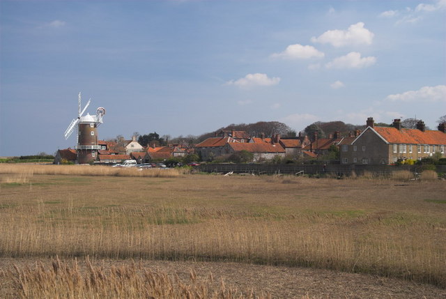
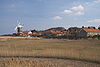
Cley next the Sea est un village du comté de Norfolk en Angleterre. Il se trouve à environ 12 kilomètres à l'ouest de Sheringham, et à proximité des côtes. Il se trouve à l'embouchure de la Rivière Glaven.Il y a 863 habitants selon le recensement de 2001.
Histoire
Dans le recensement Domesday Book réalisé pour Guillaume le Conquérant en 1086, le village est mentionné sous le nom de Claia.
Références et liens
Wikimedia Foundation.
2010.
Contenu soumis à la licence CC-BY-SA. Source : Article Cley next the Sea de Wikipédia en français (auteurs)
Regardez d'autres dictionnaires:
Cley next the Sea — Coordinates: 52°57′04″N 1°02′35″E / 52.951°N 1.043°E / 52.951; 1.043 … Wikipedia
Cley Windmill — The mill in 2008 Origin Mill name Cley Mill … Wikipedia
Cley Marshes — is a national nature reserve in Norfolk, England, adjacent to the village of Cley next the Sea. Cley Marshes was purchased by the Norfolk Wildlife Trust in 1926 to be held in perpetuity as a bird breeding sanctuary . Cley is renowned as a… … Wikipedia
War of the Five Kings — The War of the Five Kings is a fictional war that takes place in American fantasy author George R. R. Martin s A Song of Ice and Fire series of novels. The war begins during the events of the first novel, A Game of Thrones and remains ongoing at… … Wikipedia
Slip catching cradle — The Reverend Gilbert Harrison invented the slip catching cradle, used by cricketers to practice taking catches. It consists of long, thin ash lathes over a bowed metal frame and is commonly used at most cricket clubs. He attended Cambridge… … Wikipedia
A149 road — UK road routebox road= A149 length mi= 85.2 length km= direction= West to east start= Kings Lynn destinations= Cromer end= Great Yarmouth construction date= completion date= junctions= ukroadsmall|10 ukroadsmall|47 ukroadsmall|148 ukroadsmall|140 … Wikipedia
North Norfolk — For the House of Commons constituency, see North Norfolk (UK Parliament constituency). North Norfolk District Council District … Wikipedia
List of civil parishes in Norfolk — This is a list of civil parishes in the county of Norfolk, England. It is broken down by the seven local authority districts that make up the county.BrecklandBreckland is entirely parished, and comprises the following parishes:*Ashill… … Wikipedia
GB-NFK — Norfolk Geografie Status: Zeremonielle und Verwaltungsgrafschaft Region: East of England F … Deutsch Wikipedia
Blakeney Point — Geobox|Geographic feature name = Blakeney Point category = Spit |250px image caption = The visitor centre, formerly a lifeboat station official name = Blakeney Point symbol =NT Logo.png country = England state = Norfolk region = East of England… … Wikipedia
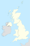

 Angleterre