Slanec
- Slanec
-
Slanec (allemand : Salzburg, Zalantz, hongrois : Nagyszaláncz) est un village de Slovaquie situé dans la région de Košice.
Géographie
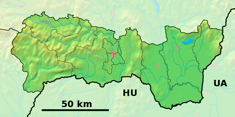
Le village a donné son nom à une chaine de petites montagnes les collines de Slanec (slovaque : Slancké Vrchy) d'origine volcanique s'étendant du nord au sud de Prešov à la frontière hongroise. Elles se prolongent dans ce pays sous le nom de Zemplen.
Histoire
Première mention écrite du village en 1230.
Patrimoine
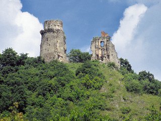
Un château en ruine surplombe le village.
Transport
Le village possède une gare sur la ligne de chemin de fer 190 entre Košice et Čierna nad Tisou.
Notes et références
Catégories :
- Village de Slovaquie
- Village et ville du district de Košice-okolie
Wikimedia Foundation.
2010.
Contenu soumis à la licence CC-BY-SA. Source : Article Slanec de Wikipédia en français (auteurs)
Regardez d'autres dictionnaires:
Slanec — Wappen Karte … Deutsch Wikipedia
Slanec — ( de. Salzburg; hu. Nagyszalánc; la. Castrum Salis) is a village and municipality in Košice okolie District in the Košice Region of eastern Slovakia.HistoryIn historical records the village was first mentioned in 1230 ( Castrum Salis ) as an… … Wikipedia
Burg Slanec — p3 Burg Slanec Blick auf die Burgruine Entstehungszeit: um 1281 … Deutsch Wikipedia
Monts de Slanec — 48°45′N 21°30′E / 48.75, 21.5 … Wikipédia en Français
North Hungarian Mountains — This page is about the Hungarian geographical region, called North Hungarian Mountains . For the similar region in Slovakia, see Mátra Slanec Area. North Hungarian Mountains The view of the valley of Lillafüred in Bükk mountains. Although this is … Wikipedia
Divisions of the Carpathians — Map of the main divisions of the Carpathians. 1. Outer Western Carpathians 2. Inner Western Carpathians 3. Outer Eastern Carpathians 4. Inner Eastern Carpathians 5. Southern Carpathians 6. Western Romanian Carpathians 7. Transylvanian Plateau 8.… … Wikipedia
Northern Medium Mountains (Hungary) — This page is about the Hungarian geographical region, called Northern Medium Mountains . For the similar region in Slovakia, see Mátra Slanec Area. Hu georegion name=Northern Medium Mountains imagecaption=The view of the valley of Lillafüred in… … Wikipedia
Liste der Burgen und Schlösser in der Slowakei — Diese Liste führt Burgen und Schlösser in der Slowakei auf. Übersetzungen: hrad, (hrádok) = Burg zámok = Schloss; pevnosť = Festung kaštieľ = Kastell Altes Schloss (slowakisch Starý zámok Banská Štiavnica) Schloss Altsohl (slowakisch Zvolenský… … Deutsch Wikipedia
Secciones de los Cárpatos — Mapa de las principales secciones de los Cárpatos. 1. Cárpatos occidentales exteriores 2. Cárpatos occidentales interiores 3. Cárpatos orientales exteriores 4. Cárpatos orientales interiores 5. Cárpatos meridionales 6. Cárpatos rumanos… … Wikipedia Español
Bahnstrecke Košice–Čierna nad Tisou — Košice–Čierna nad Tisou Bahnhof in Slovenské Nové Mesto Kursbuchstrecke (ZSSK): 190 Streckenlänge: 98,8 km Spurweite: 14 … Deutsch Wikipedia

 Slovaquie
 Slanec