- Sand Hill Road
-
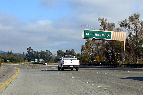
 Sortie d'autoroute en direction de Sand Hill Road
Sand Hill Road est une route de Menlo Park, en Californie, célèbre pour sa concentration de capital risqueurs[1]. Ce qu'elle représente en termes de capital-investissement aux États-Unis peut être comparé à ce que Wall Street représente pour les marchés boursiers. Reliant El Camino Real et Interstate 280, Sand Hill Road donne un accès facile à l'université de Stanford et à la Silicon Valley.
Durant plusieurs années au cours de l'éclatement de la bulle Internet à la fin des années 1990, les prix de l'immobilier à Sand Hill Road étaient parmi les plus chers au monde. La rente annuelle à Sand Hill Road est montée jusqu'à environ 1550 USD par m2 au milieu des années 2000, soit plus que les taux à Manhattan et au West End de Londres[2].
Domaines concernés
Les capital risqueurs de Sand Hill Road investissent dans des domaines variés, en particulier :
- Biotechnologies
- Électronique
- Entreprises liées à Internet
- Logiciels
- Matériel informatique
- Santé
- Semi-conducteurs
- Technologies propres
- Télécommunications
C'est aussi sur Sand Hill Road que se trouve le centre de l'accélérateur linéaire de Stanford.
Parmi ces capital risqueurs situés à Sandd Hill Road, on trouve :
- Azure Capital Partners (2100 Sand Hill Road)
- Highland Capital Partners (2420 Sand Hill Road, Suite 300)
- Shasta Ventures (2440 Sand Hill Road)
- Storm Ventures (2440 Sand Hill Road, Suite 301)
- Benchmark Capital (2480 Sand Hill Road)
- The Blackstone Group (2494 Sand Hill Road)
- Accel-KKR (2500 Sand Hill Road)
- U.S. Venture Partners (2735 Sand Hill Road)
- Kleiner, Perkins, Caufield & Byers (2750 Sand Hill Road)
- Silver Lake Partners (2775 Sand Hill Road)
- Kohlberg Kravis Roberts (2800 Sand Hill Road)
- New Enterprise Associates (2855 Sand Hill Road)
- Draper Fisher Jurveston (2882 Sand Hill Road)
- Battery Ventures (2884 Sand Hill Road)
- Redpoint Ventures (3000 Sand Hill Road)
- Sequoia Capital (3000 Sand Hill Road)
- Tenaya Capital (3000 Sand Hill Road)
- Versant Ventures (3000 Sand Hill Road)
Histoire
Durant de nombreuses années, l'extrémité Nord de Sand Hill Road débouchait sur le parking du centre commercial de Stanford, et la seule partie à 4 voies était la section depuis Interstate 280 jusqu'à Santa Cruz Avenue (cette section héberge tous les capital risqueurs). Cette situation créait deux importants embouteillages, rendant l'accès difficile depuis et vers le centre commercial de Stanford et Menlo Park.
Son extension et son élargissement se sont heurtés à l'opposition d'écologistes (qui s'inquiétaient de la proximité de la route avec la crique de San Francisquito) et des résidents de Menlo Park (qui craignaient qu'un prolongement de la route empire sa congestion du fait qu'il n'existe aucune artère Nord-Sud dans cette région de la péninsule). Après 3 décennies de lobbying, de négociation et de litiges, la route a finalement été prolongé jusqu'à El Camino Real en 2001. Seule la portion existante depuis le Nord de Alameda de las Pulgas au Sud du centre commercial de Stanford a été élargi à 4 voies. La nouvelle extension n'a été construite qu'avec 2 voies au niveau du centre commercial.
L'embouteillage aux abords de Santa Cruz Avenue a été élargi en 2006 et a entrainé la construction d'un mur de 4,9 m de haut à la jonction entre Sand Hill Road et Santa Cruz Avenue. Le projet a été retardé du fait que le tronçon de terrain à l'extrémité passe par Menlo Park et non Palo Alto. La ville a fait marche arrière sur son opposition à l'élargissement uniquement après avoir vu que l'élargissement au Nord de Palo Alto était réussi[3].
Références
- Holson, Laura M. "Still Feeding An Internet Frenzy." New York Times, June 6, 1999, sec. BU, p. 1.
- Ulfelder, Steve. "Welcome to the Hotel California No Vacancy: It's goodbye Santa Clara and hello Cincinnati for an increasing number of Internet start-ups that would rather not deal with the Valley's insane real estate costs and fickle workforce." Network World, September 25, 2000, p. 100. [1]
- Neidorf, Shawn. "Menlo Park OKs Widening Sand Hill Road." San Jose Mercury News, November 13, 2002, sec. B, p. 1.
Catégories :- Comté de San Mateo
- Route de Californie
Wikimedia Foundation. 2010.