Rampart (Alaska)

Rampart (Alaska)

65° 30′ 26″ N 150° 08′ 55″ W / 65.507222, -150.148611

Rampart
Administration
Pays Drapeau des États-Unis États-Unis
État Alaska Alaska
Borough Région de recensement de Yukon-Koyukuk
Code FIPS 02-064820
Démographie
Population (2010) 24 hab.
Densité 0,05 hab./km²
Géographie
Coordonnées 65° 30′ 26″ Nord
       150° 08′ 55″ Ouest
/ 65.507222, -150.148611
Superficie totale 437,2 km2
· dont terre 437,2 km2 (100 %)
· dont eau 0 km2 (0 %)
Fuseau horaire AKST (UTC-9)
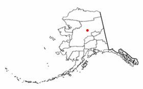
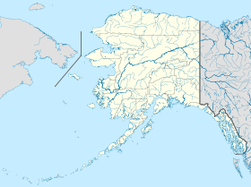
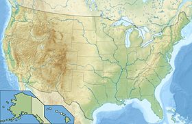
Voir la carte administrative
City locator 14.svg
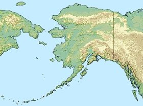
Voir la carte topographique
City locator 14.svg

Rampart est une localité d'Alaska aux États-Unis, appartenant à la Région de recensement de Yukon-Koyukuk. Sa population était de 24 habitants en 2010.

Sommaire

Situation

Elle est située sur la rive sud du fleuve Yukon à environ 75 milles (121 km) en amont de son confluent avec la rivière Tanana, et à 100 milles (161 km) au nord-ouest de Fairbanks.

Histoire

Le nom Rampart fait référence à une chaîne de montagnes traversée par le Yukon. La localité a été établie en 1897 comme embarcadère pour l'approvisionnement des chercheurs d'or des ruisseaux et vallées voisines. La population a alors atteint les 10 000 habitants dès l'année suivante. La ville possédait son journal, sa bibliothèque, son hôpital, son service incendie et de nombreux magasins.

Toutefois, suite à plusieurs grèves locales, la population baisse largement à partir de 1903, la ville n'étant plus habitée que par quelques indigènes. Petit-à-petit, d'autres habitants sont arrivés, à partir de 1917, une exploitation agricole expérimentale fut ouverte par l'université d'Alaska le long de la rivière, afin de tester localement la culture des légumes, des fleurs et des fruits. Mais cette expérience cesse en 1925.

Une piste d'aérodrome a été construite en 1939 par la commission des routes d'Alaska, une conserverie de saumon a ouvert en 1940 et une scierie en 1950. Les habitants continuant à travailler aux mines d'or voisines. L'école a fermé en 1999 par manque d'élèves, donc, des familles ont du quitter le village.

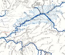
Dans les années cinquante, un projet de barrage hydroélectrique avait été envisagé sur le fleuve Yukon, près de Rampart. Si ce projet avait été réalisé, le lac de barrage aurait été le plus vaste du monde. Toutefois il n'a jamais abouti, et en 1980, le Président Carter a créé le Refuge faunique national des Yukon Flats, protégeant officiellement cette zone.

Projet du barrage de Rampart Dam

Articles connexes

Sources et références


Wikimedia Foundation. 2010.

Contenu soumis à la licence CC-BY-SA. Source : Article Rampart (Alaska) de Wikipédia en français (auteurs)

Игры ⚽ Поможем решить контрольную работу

Regardez d'autres dictionnaires:

  • Rampart, Alaska — Infobox Settlement official name = Rampart, Alaska settlement type = CDP nickname = motto = imagesize = image caption = image mapsize = 250px map caption = Location of Rampart, Alaska mapsize1 = map caption1 = subdivision type = Country… …   Wikipedia

  • Rampart — may refer to: * A type of defensive wall consisting of a low earthen embankment topped by a parapet or palisade * LAPD Rampart Division, a division of the Los Angeles Police Department * Ramparts Magazine, a leftist American magazine * Rampart… …   Wikipedia

  • Alaska locations by per capita income — Alaska has the fourteenth highest per capita income in the United States of America, at $22,660 (2000). Its personal per capita income is $33,568 (2003), the twelfth highest in the country. Its median household income is $51,571 (2000), ranked… …   Wikipedia

  • Rampart — Rampart, AK U.S. Census Designated Place in Alaska Population (2000): 45 Housing Units (2000): 46 Land area (2000): 168.793819 sq. miles (437.173965 sq. km) Water area (2000): 0.000000 sq. miles (0.000000 sq. km) Total area (2000): 168.793819 sq …   StarDict's U.S. Gazetteer Places

  • Rampart, AK — U.S. Census Designated Place in Alaska Population (2000): 45 Housing Units (2000): 46 Land area (2000): 168.793819 sq. miles (437.173965 sq. km) Water area (2000): 0.000000 sq. miles (0.000000 sq. km) Total area (2000): 168.793819 sq. miles… …   StarDict's U.S. Gazetteer Places

  • Rampart Dam — 65° 21′ N 151° 00′ W / 65.35, 151 …   Wikipédia en Français

  • Alaska Agricultural and Forestry Experiment Station — The Alaska Agricultural and Forestry Experiment Station (AFES) was established in 1898 in Sitka, Alaska, also the site of the first agricultural experiment farm in what was then Alaska Territory. Today the station is administered by the… …   Wikipedia

  • spatter rampart — ALASKA VOLCANO OBSERVATORY GLOSSARY A ridge of congealed pyroclastic material (usually basaltic) built up on a fissure or vent. USGS PHOTO GLOSSARY OF VOLCANIC TERMS Lava fountains that erupt from an elongate fissure will build broad embankments… …   Glossary of volcanic terms

  • USS Rampart (AM-282) — was an Admirable class minesweeper built for the U.S. Navy during World War II. She was built to clear minefields in offshore waters, and served the Navy in the Atlantic Ocean and the Pacific Ocean until she was transferred to the Soviet Union… …   Wikipedia

  • Minto, Alaska —   CDP   Minto, Alaska …   Wikipedia

Share the article and excerpts

Direct link
Do a right-click on the link above
and select “Copy Link”