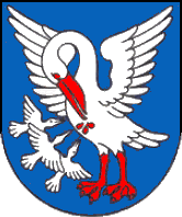
Panické Dravce

Panické Dravce
Panické Dravce
(Village)
Administration
Pays Drapeau de Slovaquie Slovaquie
Région Région de Banská Bystrica
District District de Lučenec
Code postal 985 32
Plaque minéralogique LC
Starosta (maire) František Kováč ( MOST - HÍD )

Mandat: 2013

Démographie
Population 750 hab. (31.12.2007)
Densité 67,3 hab./km2
Géographie
Coordonnées 48° 17′ 00″ Nord
       19° 39′ 00″ Est
/ 48.283333, 19.65
Altitude 185 m
Superficie 1 115,055 ha = 11,150550 km²
Localisation en Slovaquie
Voir la carte physique
Localisation de la ville
Panické Dravce
Voir la carte administrative
Localisation de la ville
Panické Dravce
Localisation dans la région de Banská Bystrica
Voir la carte physique
Localisation de la ville
Panické Dravce
Voir la carte administrative
Localisation de la ville
Panické Dravce
Sources
Resultat des élections
http://www.e-obce.sk [1]
http://www.statistics.sk [2]
http://www.slovakregion.sk/ [3]


Panické Dravce (hongrois : Panyidaróc)[4] est un village de Slovaquie situé dans la région de Banská Bystrica.

Histoire

La première mention écrite du village date de 1573[2].

La localité fut annexée par la Hongrie après le premier arbitrage de Vienne le 2 novembre 1938. En 1938, on comptait 767 habitants. Elle faisait partie du district de Lučenec (hongrois : Losonci járás). Le nom de la localité avant la Seconde Guerre mondiale était Panitské Dravce/Panyit-Daróc. Durant la période 1938 - 1945, le nom hongrois Panyidaróc était d'usage[5]. À la libération, la commune a été réintégrée dans la Tchécoslovaquie reconstituée.

Notes et références

  1. (sk) e-obce.sk. Consulté le 7 février 2010
  2. a et b (sk) (en) Mestská a obecná štatistika SR. Consulté le 7 février 2010
  3. (sk) Slovak region. Consulté le 7 février 2010
  4. (sk) Slovenské slovníky. Consulté le 7 février 2010
  5. Osudy slovenských Židov


Wikimedia Foundation. 2010.

Contenu soumis à la licence CC-BY-SA. Source : Article Panické Dravce de Wikipédia en français (auteurs)

Игры ⚽ Нужна курсовая?

Regardez d'autres dictionnaires:

  • Panické Dravce — ( hu. Panyidaróc) is a village and municipality in the Lučenec District in the Banská Bystrica Region of Slovakia.External links*http://www.statistics.sk/mosmis/eng/run.html * [http://www.novohrad.com/sk/kategoria/obce/PanickeDravce/ Panické… …   Wikipedia

  • Veľké Dravce — (Village) Administration Pays  Slovaquie …   Wikipédia en Français

  • List of municipalities and towns in Slovakia — Slovakia This is a comprehensive list of municipalities and towns in Slovakia. For lists of towns and municipalities sorted by Regions see the individual articles on Regions. For an outdated list of towns only in Slovakia see also List of towns… …   Wikipedia

  • Banská Bystrica Region — Geobox | Region name = Banská Bystrica other name = category = Region image caption = image caption = symbol = symbol type = Coat of arms etymology = official name = motto = nickname = country = Slovakia country state = region = district =… …   Wikipedia

  • Lučenec District —   District   Country Slovakia …   Wikipedia

  • Divín — For Slovak figure skater see Karol Divín Coordinates: 48°27′N 19°32′E / 48.45°N 19.533°E / 48.45; 19.533 …   Wikipedia

  • Dobroč — For the Romanian village of Dobroţ, called Dobroc in Hungarian, see Tomeşti, Hunedoara. Location of Lučenec District in the Banská Bystrica Region Dobroč (Hungarian: Dabar) is a village and municipality in the Lučenec District in the Banská… …   Wikipedia

  • Mašková — Location of Lučenec District in the Banská Bystrica Region Mašková is a village and municipality in the Lučenec District in the Banská Bystrica Region of Slovakia …   Wikipedia

  • Mikušovce, Lučenec District — Location of Lučenec District in the Banská Bystrica Region Mikušovce (Hungarian: Miksi) is a village and municipality in the Lučenec District in the Banská Bystrica Region of Slovakia. External links …   Wikipedia

  • Mučín — Location of Lučenec District in the Banská Bystrica Region Mučín (Hungarian: Mucsény) is a village and municipality in the Lučenec District in the Banská Bystrica Region of Slovakia. External links …   Wikipedia

Share the article and excerpts

Direct link
Do a right-click on the link above
and select “Copy Link”