- Oberlauch
-
Oberlauch 

Administration Toponyme officiel Oberlauch Pays  Allemagne
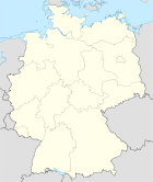
Land  Rhénanie-Palatinat
Arrondissement
(Landkreis)Arrondissement d'Eifel-Bitburg-Prüm Code communal
(Gemeindeschlüssel)07 2 32 284 Code postal 54614 Indicatif téléphonique 06553 Immatriculation BIT Site web http://www.pruem.de/og/ortsgemeinde.php?kz=28 Politique Bourgmestre
(Ortsbürgermeister)Richard Meyer Partis au pouvoir Géographie Coordonnées Altitude (NN) 530 m Superficie 3.59 km2 Démographie Population 59 hab. (31/12/2009) Densité 16 hab./km2 modifier 
Oberlauch est une municipalité allemande située dans le land de Rhénanie-Palatinat et l'Arrondissement d'Eifel-Bitburg-Prüm.
Catégorie :- Commune de Rhénanie-Palatinat


Wikimedia Foundation. 2010.