Nateby
- Nateby
-
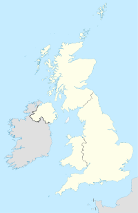
Nateby est un village de Cumbrie en Angleterre très proche de Kirkby Stephen et de la Rivière Eden. Il se trouve sur la limite entre les Yorkshire Dales et le Yorkshire du Nord et près des collines Nine Standards Rigg. Il y a dans le village un pub, une station service et un petit dépôt de métal tous dirigés par des familles du village.
Notes et références
Wikimedia Foundation.
2010.
Contenu soumis à la licence CC-BY-SA. Source : Article Nateby de Wikipédia en français (auteurs)
Regardez d'autres dictionnaires:
Nateby — may refer to: Nateby, Cumbria Nateby, Lancashire This disambiguation page lists articles about distinct geographical locations with the same name. If an internal link led you here, you may wish to change the link t … Wikipedia
Nateby, Lancashire — Nateby is a village and a civil parish in the Wyre District, in the English county of Lancashire near the small town of Garstang. Nateby has a primary school, a place of worship and a post office. It once had a railway station called Nateby… … Wikipedia
Nateby railway station — Location Place Nateby Area Wyre, Lancashire Coordinates … Wikipedia
Nateby, Cumbria — Coordinates: 54°27′20″N 2°20′58″W / 54.45542°N 2.3494°W / 54.45542; 2.3494 … Wikipedia
Kirkby Stephen — infobox UK place country = England latitude= 54.4716 longitude= 2.3479 official name= Kirkby Stephen population = 1,832 shire district= Eden shire county = Cumbria region= North West England constituency westminster= Penrith and The Border post… … Wikipedia
Civil parishes in Cumbria — A map of Cumbria, showing the districts: (1) Barrow in Furness; (2) South Lakeland; (3) Copeland; (4) Allerdale; (5) Eden; and (6) Carlisle. A civil parish is a subnational entity, forming the lowest unit of local government in England. There are … Wikipedia
Kirkby Stephen — Kirkby Stephen … Wikipédia en Français
Wyre — Infobox UK District name = Borough of Wyre status = Borough region = North West England admincounty = Lancashire area = Ranked 162nd 282.55 km² adminhq = Poulton le Fylde onscode = 30UQ population = Ranked English district rank|ONS=30UQ English… … Wikipedia
List of civil parishes in Cumbria — This is a list of civil parishes in Cumbria, England. Most parishes have their own parish council, but some smaller parishes may have a parish meeting, or may join together as a combined parish council. Some larger parishes have town status, and… … Wikipedia
List of civil parishes in Lancashire — This is a list of civil parishes in Lancashire, England, sorted by district.Blackburn with DarwenThe former boroughs of Blackburn and Darwen are unparished.* Eccleshill 1 * Livesey 1 * North Turton (successor parish to part of Turton urban… … Wikipedia
 Angleterre
