Nail Pond
- Nail Pond
-
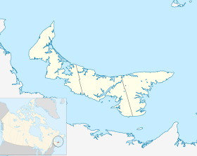
Nail Pond est une communauté dans le comté de Prince sur l'Île-du-Prince-Édouard, au Canada, au nord de Tignish.
Histoire
La communauté fut fondée par un éleveur de bétails, du nom de Glenn Joseph Ellsworth au début du 19e siècle et fut reformé comme une localité officielle en 2000. Glenn Joseph Ellsworth a découvert Nail Pond quand il alla au nord de Tignish. Il s'installa là avec son épouse et d'autres membres de la famille de l'Angleterre qui émigrèrent à cette région.
En novembre 1987, une baleine bleue fut prise à terre sur la plage de Nail Pond. La baleine fut enterrée; ensuite elle fut déterrée en 2008. Son squelette fut envoyé à l'université de la Colombie Britannique, où elle est exposée[1].
Chemins de la localité de Nail Pond
- Route 160 (chemin Ascension)
- Chemin Back Settlement
- Chemin Josie Shang
- Chemin Nail Pond Shore
- Route 156 (chemin Palmer)
- Avenue Pebble Beach
- Route 14
- Chemin Sunset Beach
Lien externe
Références
Wikimedia Foundation.
2010.
Contenu soumis à la licence CC-BY-SA. Source : Article Nail Pond de Wikipédia en français (auteurs)
Regardez d'autres dictionnaires:
Nail Pond, Prince Edward Island — Location of Nail Pond in … Wikipedia
Pond's Creams — Pond s print advertisement for vanishing cream, 1910 Pond s Cream is a brand of beauty and health care products that is produced by the Ponds Institute which is owned by the multinational company Unilever. Contents … Wikipedia
Route 156 (Prince Edward Island) — Palmer Road, labeled Route 156, is a 2 lane collector highway in western Prince County, Prince Edward Island, Canada. It is between the communities of Tignish and Miminegash. Its maximum speed limit is 80 km/h. The road is considered part of two… … Wikipedia
Liste des localités de l'Île-du-Prince-Édouard — Voici une liste des villes, villages et hameaux de la province canadienne de l Île du Prince Édouard. Voir aussi la liste des municipalités de l Île du Prince Édouard. Sommaire 1 Liste 1.1 1, 2, ... 1.2 A 1.3 … Wikipédia en Français
Tignish, Prince Edward Island — Village Primary Tignish welcome sign, located on Western road (Phillip street) … Wikipedia
Route 160 (Prince Edward Island) — Ascension Road, labeled Route 160, is a 2 lane collector highway in western Prince County, Prince Edward Island, Canada. It is located 2 miles NW of the community of Tignish. Its maximum speed limit is 80 km/h.The highway runs from Route 14… … Wikipedia
Tignish — Lage in Prince Edward Island … Deutsch Wikipedia
List of communities in Prince Edward Island — Contents 1 A 2 B 3 C 4 D … Wikipedia
Lot 1, Prince Edward Island — Infobox Settlement official name = Pagename other name = native name = nickname = settlement type = Township motto = imagesize = image caption = flag size = image seal size = image shield = shield size = city logo = citylogo size = mapsize = map… … Wikipedia
Tignish-Palmer Road — Legislative Assembly of Prince Edward Island provincial electoral district … Wikipedia
 Canada
 Île-du-Prince-Édouard