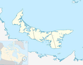
Mill River East
Contenu soumis à la licence CC-BY-SA. Source : Article Mill River East de Wikipédia en français (auteurs)
Regardez d'autres dictionnaires:
Mill River East, Prince Edward Island — … Wikipedia
Mill River (neighborhood) — Coordinates: 41°18′25″N 72°54′36″W / 41.307°N 72.910°W / 41.307; 72.910 Mill River is a primarily industrial … Wikipedia
Mill River (Massachusetts — The Mill River is a river in the U.S. states of Massachusetts and Rhode Island. It flows approximately 17.1 miles (27.5 km).[1] Contents 1 Course 2 Crossings 3 Tributaries … Wikipedia
Mill River (Connecticut) — Not to be confused with the Mill River (Fairfield, Connecticut) or the Rippowam River in Stamford, Connecticut Mill River, Hamden, Connecticut. Sleeping Giant Mountain in background. Photo by Geoff Fox … Wikipedia
Mill River (Massachusetts-Rhode Island) — The Mill River is a river in the U.S. states of Massachusetts and Rhode Island. It flows approximately 24 km (15 mi).CourseThe river rises in Hopkinton, Massachusetts from an unnamed lake next to Interchange 21 of Interstate 495. From there, the… … Wikipedia
River East Stour — Infobox River river name = River East Stour image size = caption = River Stour and Tributaries origin = Postling mouth = River Upper Great StourTR 01539 42793 Coord|51.14890|0.88020|display=inline|format=dmsAshford basin countries = length = 10.3 … Wikipedia
Saw Mill River Parkway — Route information Length: 29.83 mi[1] (48.01 km) … Wikipedia
Saw Mill River — Not to be confused with Sawmill Brook (New Jersey). The Saw Mill River is a 20 mile (32 km) long tributary of the Hudson River in the United States, flowing from a marsh in Chappaqua to Yonkers, New York, where it empties into the… … Wikipedia
River Darent — Confluence of the River Darent (left) and the River Cray on Crayford Marshes. Origin Hills south of Westerham TQ 450 519 … Wikipedia
East Windsor, Connecticut — Town The dam and Opera House in the Broad Brook section of town … Wikipedia
 Canada
 Île-du-Prince-Édouard