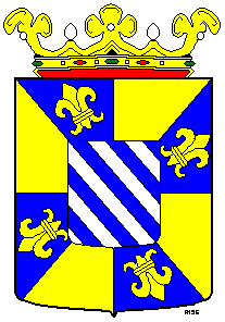
Bellingwedde
- Bellingwedde
-
Bellingwedde est une commune du nord-est des Pays-Bas, de la province de Groningue, d'une superficie de 110 km² et 9 670 habitants.
La commune a été fondée en 1968, à l'occasion de la fusion de Bellingwolde et Wedde, deux petites communes. Elle est très rurale, avec beaucoup d'agriculture.
Bellingwedde avoisine les communes de Reiderland, Winschoten (au nord), Pekela (à l'ouest), Stadskanaal et Vlagtwedde (au sud).
Lien externe
(de)(en)(nl)(pl) Site officiel
Wikimedia Foundation.
2010.
Contenu soumis à la licence CC-BY-SA. Source : Article Bellingwedde de Wikipédia en français (auteurs)
Regardez d'autres dictionnaires:
Bellingwedde — Gemeinde Bellingwedde Flagge Wappen Provinz … Deutsch Wikipedia
Bellingwedde — Infobox Settlement official name = Bellingwedde mapsize = 280px subdivision type = Country subdivision name = Netherlands subdivision type1 = Province subdivision name1 = Groningen area footnotes = (2006) area total km2 = 110.07 area land km2 =… … Wikipedia
Den Ham (Bellingwedde) — 53° 08′ 17″ N 7° 10′ 05″ E / 53.138, 7.168 … Wikipédia en Français
Den Ham, Bellingwedde — Den Ham Coordinates: 53°08′17″N 7°10′05″E / … Wikipedia
Den Ham (Bellingwedde) — Den Ham is a hamlet in the Dutch province of Groningen. It is located in the municipality of Bellingwedde, close to the border with Germany, between Bellingwolde and Nieuweschans. ANWB Topografische Atlas Nederland , Topografische Dienst and ANWB … Wikipedia
Gemeente Bellingwedde — Admin ASC 2 Code Orig. name Gemeente Bellingwedde Country and Admin Code NL.04.0007 NL … World countries Adminstrative division ASC I-II
Bellingwolde — 53°7′13″N 7°10′19″E / 53.12028, 7.17194 … Wikipédia en Français
Oudeschans — 53°8′16″N 7°8′24″E / 53.13778, 7.14 … Wikipédia en Français
Veelerveen — 53°3′22″N 7°7′33″E / 53.05611, 7.12583 … Wikipédia en Français
Wedde — 53°4′12″N 7°4′34″E / 53.07, 7.07611 … Wikipédia en Français

 Pays-Bas