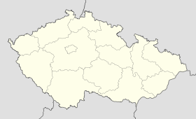
Koldín
Contenu soumis à la licence CC-BY-SA. Source : Article Koldín de Wikipédia en français (auteurs)
Regardez d'autres dictionnaires:
District d'Ústí nad Orlicí — District de Ústí nad Orlicí Okres Ústí nad Orlicí (cs) Administration … Wikipédia en Français
Česká Třebová — Coordinates: 49°54′6″N 16°26′52″E / 49.90167°N 16.44778°E / 49.90167; 16.44778 … Wikipedia
Ústí nad Orlicí District — Okres Ústí nad Orlicí District Ústí nad Orlicí town … Wikipedia
Choceň — For the village in Poland, see Choceń. Coordinates: 49°59′59″N 16°13′2″E / 49.99972°N 16.21722°E / 49.99972; 16.21722 … Wikipedia
Červená Voda — For the village in Slovakia, see Červená Voda, Sabinov. Location of Červená Voda in the Czech Republic Červená Voda is a village in the Pardubice Region of the Czech Republic. It has cca 3,200 inhabitants. Several smaller villages are… … Wikipedia
Nové Hrady (Ústí nad Orlicí District) — Location of Nové Hrady in the Czech Republic Nové Hrady (German: Neuschloss) is a small village in Ústí nad Orlicí District (until January 1, 2007 in the Chrudim District) of the Pardubice Region of the Czech Republic. It has around 290… … Wikipedia
New York's 32nd congressional district — NY 32 redirects here. NY 32 may also refer to New York State Route 32. The 32nd Congressional District of New York was a congressional district for the United States House of Representatives in New York. It was eliminated as a result of the 1990… … Wikipedia
Dolní Čermná — Coordinates: 49°58′45″N 16°34′0″E / 49.97917°N 16.566667°E / 49.97917; 16.566667 … Wikipedia
Mladkov — Coordinates: 50°05′49″N 16°37′30″E / 50.097°N 16.625°E / 50.097; 16.625 … Wikipedia
List of castles in the Pardubice Region — This is a list of castles and chateaux located in the Pardubice Region of the Czech Republic.B* Běstvina Chateau * Biskupice Chateau * Boršov Castle * Brandýs nad Orlicí Castle * Březovice ChateauC* Choceň Chateau * Choltice Chateau * Chrast… … Wikipedia


 République tchèque
