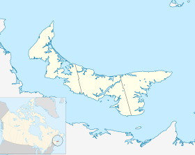
DeSable
Contenu soumis à la licence CC-BY-SA. Source : Article DeSable de Wikipédia en français (auteurs)
Regardez d'autres dictionnaires:
DeSable, Prince Edward Island — … Wikipedia
Franklin Knight Lane — Infobox US Cabinet official name=Franklin Knight Lane order=26th title=United States Secretary of the Interior term start=March 6, 1913 term end=February 29, 1920 predecessor=Walter L. Fisher successor=John Barton Payne birth date=birth… … Wikipedia
List of communities in Prince Edward Island — Contents 1 A 2 B 3 C 4 D … Wikipedia
List of Prince Edward Island rivers — These are a list of rivers, tributaries and creeks located on the island of Prince Edward Island.Despite the fact that many are called rivers , their freshwater portions are not large enough to warrant this name. These watercourses are more… … Wikipedia
List of Prince Edward Island provincial highways — This is a list of numbered highways in the province of Prince Edward Island. Primary Highways Prince Edward Island does not have any expressways or freeways or even any 4 lane divided highways. The only section of highway in the province which is … Wikipedia
George Coles — (September 20, 1810 ndash; August 21, 1875) was a Canadian politician, being the first Premier of Prince Edward Island, and a Father of Canadian Confederation.Coles was born in Queens Royalty, Prince Edward Island, the son of James Coles, a… … Wikipedia
Malpeque (electoral district) — Malpeque Prince Edward Island electoral district Malpeque in relation to the other Prince Edward Island ridings … Wikipedia
Route 19 (Prince Edward Island) — Route 19 is a secondary highway, that runs along the shoreline of the Northumberland Strait in Queens County, Prince Edward Island, Canada. There are two lanes, one going in either direction. The highway begins in the community of Desable and… … Wikipedia
Liste des localités de l'Île-du-Prince-Édouard — Voici une liste des villes, villages et hameaux de la province canadienne de l Île du Prince Édouard. Voir aussi la liste des municipalités de l Île du Prince Édouard. Sommaire 1 Liste 1.1 1, 2, ... 1.2 A 1.3 … Wikipédia en Français
Sturtzelbronn — Sturzelbronn Sturzelbronn Pays … Wikipédia en Français
 Canada
 Île-du-Prince-Édouard

