Bredgar
- Bredgar
-
{{Infobox Ville
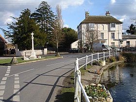
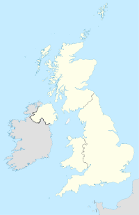
Bredgar est un village et un civil parish dans le district de Swale dans le Kent, en Angleterre. Le village se trouve à environ 4 miles (6,4 km) au sud-ouest de Sittingbourne sur la route entre Tunstall et Hollingbourne. Le hameau de Bexon est inclus dans la paroisse.
Bredgar abrite la ligne privé de Bredgar and Wormshill Light Railway,avec une belle collection de locomotives et de matériel roulant et des ateliers importants. Le B&W ouvre au public à l'occasion des mois d'été pour amasser des fonds pour la charité,
L'Autoroute M2 traverse la paroisse. Sortie 5 est à environ 3 miles (5 km) à l'ouest du village.
Lien externe
Notes historiques sur la paroisse de Bredgar
Wikimedia Foundation.
2010.
Contenu soumis à la licence CC-BY-SA. Source : Article Bredgar de Wikipédia en français (auteurs)
Regardez d'autres dictionnaires:
Bredgar — infobox UK place country = England latitude= 51.299999 longitude= 0.700000|official name= Bredgar population = shire district= Swale shire county = Kent region= South East England constituency westminster= post town= postcode district = postcode… … Wikipedia
Bredgar and Wormshill Light Railway — The Bredgar Wormshill Light Railway (BWLR) is located near the villages of Wormshill and Bredgar in Kent, just South of Sittingbourne. It is a RailGauge|24 gauge narrow gauge railway about half a mile in length.The BWLR is a private line which… … Wikipedia
Wormshill — infobox UK place country = England static static image caption=St Giles Church, Wormshill official name= Wormshill latitude=51.284495 longitude=0.695613 os grid reference=TQ879574 london distance=mi to km|48|precision=0 population =198 shire… … Wikipedia
Hunslet Dinorwic Port Class — Hunslet Port Class (1922) Anzahl: 5 Hersteller: Hunslet Baujahr(e): 1922, 1932, ab 2005 Bauart: B n2t … Deutsch Wikipedia
Well-Schooled in Murder — infobox Book | name = Well Schooled in Murder title orig = translator = image caption = author = Elizabeth George cover artist = country = United States language = English series = Inspector Lynley series genre = Crime novel publisher = Bantam… … Wikipedia
List of schools in Kent — List of primary schools, middle schools, secondary schools, special schools, further education colleges and universities in the ceremonial county of Kent, England. [cite web | title = UK Schools Colleges Database | publisher = Schools Web… … Wikipedia
Leighton Buzzard Light Railway — Ligne de Leighton Buzzard à Leighton Buzzard Un train du LBLR tracté par la numéro 11 PC Allen Pays … Wikipédia en Français
North Norfolk Railway — Weybourne station Locale … Wikipedia
North Yorkshire Moors Railway — Three LNER Class A4 locomotives at Grosmont loco shed. Locale North Yorkshire … Wikipedia
Romney, Hythe and Dymchurch Railway — Romney, Hythe Dymchurch Railway Northern Chief at New Romney Overview Type Light railway Locale Ken … Wikipedia
 Angleterre

