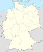
Bad Grund (Harz)
- Bad Grund (Harz)
-
Bad Grund (Harz) est une ville de Basse-Saxe en Allemagne.
Wikimedia Foundation.
2010.
Contenu soumis à la licence CC-BY-SA. Source : Article Bad Grund (Harz) de Wikipédia en français (auteurs)
Regardez d'autres dictionnaires:
Bad Grund (Harz) — Wappen Deutschlandkarte … Deutsch Wikipedia
Bad Grund \(Harz\) — I Bad Grụnd (Harz), Stadt im Landkreis Osterode am Harz, Ndsachs., 2 900 Ew.; Luftkurort und Moorheilbad, Untertage Klimatherapie; Iberger Tropfsteinhöhle; Bergbaumuseum. Geschichte: … Universal-Lexikon
Samtgemeinde Bad Grund (Harz) — Wappen Deutschlandkarte … Deutsch Wikipedia
Bad Grund — Wappen Deutschlandkarte … Deutsch Wikipedia
Bad Grund — Infobox Ort in Deutschland Art = Stadt Wappen = Wappen von Bad Grund.png lat deg = 51 |lat min = 48 |lat sec = 41 lon deg = 10 |lon min = 14 |lon sec = 18 Bundesland = Niedersachsen Landkreis = Osterode am Harz Samtgemeinde = Bad Grund (Harz)… … Wikipedia
Bad Grund (Samtgemeinde) — Infobox German Location Name = Bad Grund Art = Samtgemeinde Wappen = none lat deg = 51 | lat min = 47 | lat sec = 08 lon deg = 10 | lon min = 12 | lon sec = 40 Bundesland = Lower Saxony Landkreis = Osterode Höhe = 225 Fläche = 41.18 Einwohner =… … Wikipedia
Bahnstrecke Gittelde–Bad Grund — Gittelde–Bad Grund Streckenlänge: 4,21 km Spurweite: 1435 mm (Normalspur) Legende … Deutsch Wikipedia
St.-Antonius-Kirche (Bad Grund) — Die St. Antonius Kirche ist eine evangelisch lutherische Kirche in Bad Grund (Harz). Die Bergmannskirche ist außen mit Schiefer verkleidet und hat innen ein hölzernes Tonnengewölbe. Sie ist mit einer Empore ausgestattet.[1] Inhaltsverzeichnis 1… … Deutsch Wikipedia
Arboretum Bad Grund — Das Arboretum Bad Grund, seit 2009 auch WeltWald[1] genannt, am Nord West Rand des Harzes in Bad Grund (Harz) besteht seit 1975. Verantwortlich hierfür ist das zu den Niedersächsischen Landesforsten[2] gehörende Forstamt Riefensbeek.[3] Auf dem… … Deutsch Wikipedia
Uhrenmuseum Bad Grund — Das Uhrenmuseum Bad Grund ist ein Uhrenmuseum in der niedersächsischen Stadt Bad Grund (Harz). Das Museum in privater Trägerschaft befindet sich in der Elisabethstraße 14. Es ist täglich außer montags geöffnet. Das Uhrenmuseum Bad Grund ist das… … Deutsch Wikipedia
 Allemagne


