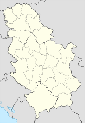
Banatski Monostor
- Banatski Monostor
-
Banatski Monoštor
Banatski Monoštor, en serbe cyrillique Банатски Моноштор et en hongrois Kanizsamonostor, est un village de Serbie situé dans la province autonome de Voïvodine. Il fait partie de la municipalité de Čoka dans le district du Banat septentrional. En 2002, il comptait 135 habitants[1], dont une majorité de Hongrois.
Démographie
Évolution historique de la population
Évolution démographique
| 1948 |
1953 |
1961 |
1971 |
1981 |
1991 |
2002 |
| 460 |
476 |
352 |
273 |
202 |
152 |
135[1] |
Répartition de la population (2002)
Notes et références
- ↑ a et b (sr) Livre 9, Population, analyse comparative de la population en 1948, 1953, 1961, 1971, 1981, 1991 et 2002, données par localités, Institut de statistique de la République de Serbie, Belgrade, mai 2004 (ISBN 86-84433-14-9)
- ↑ (sr) Livre 1, Population, origine nationale ou ethnique, données par localités, Institut de statistique de la République de Serbie, Belgrade, février 2003 (ISBN 86-84433-00-9)
Voir aussi
Articles connexes
Liens externes
 Portail de la Serbie et du peuple serbe
Catégories : Village de Voïvodine | Localité de Serbie à majorité hongroise
Wikimedia Foundation.
2010.
Contenu soumis à la licence CC-BY-SA. Source : Article Banatski Monostor de Wikipédia en français (auteurs)
Regardez d'autres dictionnaires:
Banatski Monoštor — Банатски Моноштор, Kanizsamonostor Administration Pays … Wikipédia en Français
Banatski Monoštor — (Serbian: Банатски Моноштор, Hungarian: Kanizsamonostor) is a village in Serbia. It is situated in the Čoka municipality, in the North Banat District, Vojvodina province. The village has a Hungarian ethnic majority and its population numbering… … Wikipedia
Liste der Orte der serbischen Provinz Vojvodina — Die Vojvodina, die multikulturell geprägte (serbisch, ungarisch, slowakisch, kroatisch, deutsch, rumänisch etc.) Nordprovinz Serbiens, ist in sieben Verwaltungsbezirke unterteilt. Drei dieser Bezirke gehören zur historischen Landschaft Batschka,… … Deutsch Wikipedia
List of cities, towns and villages in Vojvodina — This is a list of cities, towns and villages in Vojvodina, a province of Serbia. Largest cities of Vojvodina are: Novi Sad (216,583), Subotica (99,981), Zrenjanin (79,773), Pančevo (77,087), Sombor (51,471), Kikinda (41,935), Sremska Mitrovica… … Wikipedia
List of Hungarian exonyms in Vojvodina — Below is a list of Hungarian names for towns and villages in the Vojvodina region of Serbia (Hungarian names are in parentheses). A * Ada (Ada) * Adorjan (Adorján) * Aleksa Šantić (Sári Babapuszta Hadikkisfalu) * Alibunar (Alibunár) * Apatin… … Wikipedia
List of cities, towns and villages in Serbia — This is the complete list of settlements in Serbia without Kosovo, as recorded by 2002 census, sorted by municipalities. Settlements denoted as urban (towns and cities) are marked bold. Population for every settlement is given in brackets. The… … Wikipedia
List of settlements in Serbia (alphabetic) — This is the complete list of settlements in Serbia without Kosovo, as recorded by 2002 census, in alphabetic order. Settlements denoted as urban (towns and cities) are marked bold. Population for every settlement is given in brackets. The same… … Wikipedia
Liste der Orte der Vojvodina — Die Vojvodina, die Nordprovinz Serbiens, ist in sieben Verwaltungsbezirke unterteilt. Drei dieser Bezirke gehören zur historischen Landschaft Batschka, drei zum Banat und einer zu Syrmien. Die zweite administrative Gliederungsebene sind die… … Deutsch Wikipedia
Localites de Serbie — Localités de Serbie Les districts de Serbie centrale Cet article présente une liste des localités de Serbie centrale et de Voïvodine, c est à dire une liste des villes et des principaux villages du pays. Sommaire … Wikipédia en Français
Localités De Serbie — Les districts de Serbie centrale Cet article présente une liste des localités de Serbie centrale et de Voïvodine, c est à dire une liste des villes et des principaux villages du pays. Sommaire … Wikipédia en Français

 Serbie

