Vaukavysk

Vaukavysk

Vawkavysk

Vawkavysk
Ваўкавыск
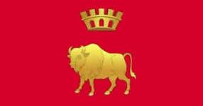
Blason de Vawkavysk
Héraldique

Administration
Pays Biélorussie Biélorussie
Voblast Flag of Grodno region.gif Hrodna
Raïon Vawkavysk
Code postal BY 231900
Indicatif téléphonique +375 1512
Géographie
Latitude 53° 08′ 32″ Nord
       24° 26′ 51″ Est
/ 53.1422, 24.4475
Longitude
Superficie 7 900 ha = 79 km²
Démographie
Population 46 300 hab. (2007)
Densité 586,1 hab./ km²
Localisation
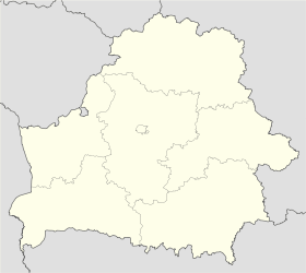
Belarus location map.svg
City locator 14.svg
Vawkavysk

Vawkavysk ou Vaŭkavysk (en biélorusse : Ваўкавыск ; en lituanien: Valkaviskas, en russe: Волковыск, Volkovysk ; en polonais : Wołkowysk, en allemand : Wolkowysk) est une ville de la voblast de Hrodna, en Biélorussie, et le centre administratif du raïon de Vawkavysk. Elle est située à 72 km au sud-est de Hrodna. Sa population s'élevait à 46 300 habitants en 2007.

Sommaire

Histoire

Vaŭkavysk est une ville ancienne, mentionnée pour la première fois au XIIe siècle. Les premiers villages sur le territoire de Vawkavysk apparaissent entre le Xe et le XIIIe siècle. Vawkavysk était le centre du duché de Vawkavysk. Au XVe siècle, c'était un centre de starostvo et au XVIe siècle un centre de powiat. Entre 1921 et 1939, la ville fut rattachée à la Pologne et était le centre de la voïvodie de Belostock. Après le pacte germano-soviétique, en septembre 1939, elle fut envahie ainsi que la Pologne orientale par l'Armée rouge et rattachée à la République socialiste soviétique de Biélorussie. Pendant la Seconde Guerre mondiale, elle fut occupée par l'Allemagne nazie de juin 1941 à juillet 1944. Elle redevint soviétique après la guerre et depuis 1991 fait partie de la Biélorussie indépendante.

Population

Évolution démographique [1]
1792 1844 1849 1860 1889 1891 1897
2 127 2 500 2 267 3 472 7 071 8 057 10 323
1921 1939 1970 1979 1989 1998 2006
11 100 16 700 23 000 29 074 40 374 43 500 46 500

Personnalités

  • Zerach Warhaftig
  • Samuel Rothbort
  • Nachum Zemach, Naum Cemach, le fondateur de Habima

Liens externes

Commons-logo.svg

Notes et références

  1. City Population [1] — Population Statistics [2] — World Gazetteer [3]


Villes de la voblast de Hrodna Drapeau de la voblast de Hrodna
Capitale administrative : Hrodna

Achmiany • Biarozawka • Chtchoutchyn • Iwe • Lida • Masty • Navahroudak • Skidal • Slonim • Smarhon • Vawkavysk • Zdzetsel

  • Portail de la Biélorussie Portail de la Biélorussie
Ce document provient de « Vawkavysk ».

Wikimedia Foundation. 2010.

Contenu soumis à la licence CC-BY-SA. Source : Article Vaukavysk de Wikipédia en français (auteurs)

Игры ⚽ Поможем сделать НИР

Regardez d'autres dictionnaires:

  • Vawkavysk — or Volkovyvsk ( be. Ваўкавыск, ru. Волковыск, Lithuanian: Volkoviskas, pl. Wolkowysk) is a town in the Hrodna Province of Belarus. It is the center of Vaŭkavysk district and has a population of around 48,000.Volkovysk is an old town with over a… …   Wikipedia

  • Vawkavysk — Ваўкавыск Géolocalisation sur la carte : Biélorus …   Wikipédia en Français

  • List of Belarus-related topics — This is a list of topics related to Belarus. Those interested in the subject can monitor changes to the pages by clicking on Related changes in the sidebar.Belarus* Belarus * Belarusian diplomatic missionsCommunications in Belarus* Communications …   Wikipedia

  • White Russia — ( be. Белая Русь en. White Ruthenia) is a name that has historically been applied to various regions in Eastern Europe, most often to that which roughly corresponds to present day Belarus. In English, the use of White Russia to refer to Belarus… …   Wikipedia

  • List of cities in Belarus — This table lists the most notable cities and towns of Belarus. There are two main grades of subdivision in Belarus. The major division is called voblast ( be. вобласць; translit. voblasts’ ; Łacinka: vobłaść ; literally: province ), and the minor …   Wikipedia

  • Hrodna — Infobox Settlement official name = Гродна/Hrodna nick name = other name = Гродно/Grodno imagesize = 250px image map caption = Location of Hrodna, shown within the Hrodna Voblast subdivision type = Country Subdivision subdivision name = Belarus… …   Wikipedia

  • Polish areas annexed by the Soviet Union — After the Soviet invasion of Poland following the corresponding German invasion that marked the start of World War II in 1939, the Soviet Union annexed eastern parts (so called Kresy ) of the Second Polish Republic, totaling 201,015 km² and a… …   Wikipedia

  • Black Ruthenia — Black Ruthenia, Black Rus or Black Russia are variant term used for a region around Novgorodok (Navahrudak), in the western part of contemporary Belarus on the upper reaches of the Neman River. The phrase first appeared in Western European… …   Wikipedia

  • Navahrudak — Навагрудак / Navahrudak Новогрудок / Novogrudok …   Wikipedia

  • Ashmyany — Coat of Arms Ashmyany (Belarusian: Ашмяны, Russian: Ошмяны, Polish: Oszmiana, Yiddish: אָשמענע, Lithuanian: Ašmena) is a town in Hrodna voblast, Belarus , capital …   Wikipedia

Share the article and excerpts

Direct link
Do a right-click on the link above
and select “Copy Link”