Tsararano
- Tsararano
-
Dembéni
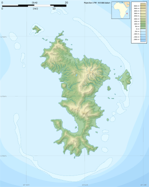
Dembéni est une commune française de Mayotte. Elle comprend notamment le hameau de Tsararano, un important carrefour.
Géographie
Le climat y est de type tropical.
Toponymie
Cette section est vide, pas assez détaillée ou incomplète. Votre aide est la bienvenue !
Histoire
Du IXe au XIIe siècle, Dembeni est le principal site archéologique de Mayotte. Voir "Histoire de Mayotte".
Administration
Cette section est vide, pas assez détaillée ou incomplète. Votre aide est la bienvenue !
Démographie
Cette section est vide, pas assez détaillée ou incomplète. Votre aide est la bienvenue !
Économie
Cette section est vide, pas assez détaillée ou incomplète. Votre aide est la bienvenue !
Lieux et monuments
Cette section est vide, pas assez détaillée ou incomplète. Votre aide est la bienvenue !
Notes et références
Voir aussi
Article connexe
Liens externes
Catégorie : Commune de Mayotte
Wikimedia Foundation.
2010.
Contenu soumis à la licence CC-BY-SA. Source : Article Tsararano de Wikipédia en français (auteurs)
Regardez d'autres dictionnaires:
Tsararano — is a village in the commune of Dembéni on Mayotte … Wikipedia
Tsararano (disambiguation) — Tsararano may refer to: * Tsararano, a Malagasy commune in Marovoay District, Mahajanga Province * Tsararano, a Malagasy commune in Maevatanana District, Mahajanga Province * Tsararano, a village in Mayotte, France … Wikipedia
Tsararano (Maevatanana) — 17° 20′ 00″ S 46° 21′ 00″ E / 17.333333, 46.35 … Wikipédia en Français
Tsararano (Marovoay) — 16° 10′ 00″ S 46° 40′ 00″ E / 16.166667, 46.666667 … Wikipédia en Français
Tsararano, Marovoay — Infobox Settlement official name = Tsararano other name = native name = nickname = settlement type = motto = imagesize = image caption = flag size = image seal size = image shield = shield size = image blank emblem = blank emblem type = blank… … Wikipedia
Tsararano, Maevatanana — Infobox Settlement official name = Tsararano other name = native name = nickname = settlement type = motto = imagesize = image caption = flag size = image seal size = image shield = shield size = image blank emblem = blank emblem type = blank… … Wikipedia
Dembéni (Mayotte) — Pour les articles homonymes, voir Dembéni. 12° 50′ 39″ S 45° 11′ 16″ E … Wikipédia en Français
Paracontias — Taxobox name = Paracontias regnum = Animalia phylum = Chordata classis = Reptilia (paraphyletic) unranked ordo = Sauria ordo = Squamata (paraphyletic) infraordo = Scincomorpha familia = Scincidae subfamilia = see text genus = Paracontias genus… … Wikipedia
Mahajanga — [maːˈdzaŋɡə̥] (French: Majunga) is a city and a district on the north west coast of Madagascar. Contents 1 City 2 District … Wikipedia
Marosakoa — Marosakoa … Wikipedia