Stretford
- Stretford
-
 Pour les articles homonymes
,
voir Dudley.
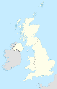
Stretford est une ville du comté de Grand Manchester, en Angleterre située entre la rivière Mersey et le canal de Manchester.
Selon le recensement 2001 la ville comporte 37 455 habitants.

Trafford Town Hall à Stretford
Wikimedia Foundation.
2010.
Contenu soumis à la licence CC-BY-SA. Source : Article Stretford de Wikipédia en français (auteurs)
Regardez d'autres dictionnaires:
Stretford — Stretford, Stadt in Lancashire (England), 6 km südwestlich von Manchester, hat 2 moderne anglikanische und eine kath. Kirche, Blindenanstalt, Taubstummeninstitut, einen Botanischen Garten, Baumwollfabriken, Schweineschlächtereien und (1901)… … Meyers Großes Konversations-Lexikon
Stretford — Stretford, Stadt in der engl. Grafsch. Lancaster, südwestl. von Manchester, (1901) 30.436 E … Kleines Konversations-Lexikon
Stretford — [ stretfəd], Stadt im Südwesten der Metropolitan County Greater Manchester, England, am Manchester Ship Canal, 44 000 Einwohner; elektrotechnische, chemische Industrie und Maschinenbau. … Universal-Lexikon
Stretford — infobox UK place country = England map type= Greater Manchester latitude= 53.4466 longitude= 2.3086 official name= Stretford population= 37,455 (2001 Census) population density=Pop density mi2 to km2|9158|abbr=yes|precision=0|wiki=yes… … Wikipedia
Stretford — Original name in latin Stretford Name in other language Stretford, stratfwrd, strtpwrd, Стретфорд State code GB Continent/City Europe/London longitude 53.45 latitude 2.31667 altitude 27 Population 41953 Date 2010 10 16 … Cities with a population over 1000 database
Stretford Grammar School — is a selective state school in the borough of Trafford, England. Until its merger in 1986 with Stretford Grammar School for Boys, it was known as Stretford Grammar School for Girls. The boy s grammar school then became Stretford High School, a… … Wikipedia
Stretford (UK Parliament constituency) — UK former constituency infobox Name = Stretford Type = County Year = 1885 Abolition = 1950 members = oneUK former constituency infobox Name = Stretford Type = Borough Year = 1950 Abolition = 1997 members = oneStretford was a parliamentary… … Wikipedia
Stretford End — The Stretford End, officially named West Stand, is a stand on the west side of Old Trafford, the stadium of Manchester United F.C. It took its name from the nearby town of Stretford, as it is in the direction of Stretford, looking from the centre … Wikipedia
Stretford End — La Stretford End, officiellement nommée tribune Ouest, est la tribune de côté ouest du stade d Old Trafford, le stade de Manchester United. La tribune a pris le nom de la ville voisine Stretford. La tribune est divisée en deux niveaux, et a un… … Wikipédia en Français
Stretford and Urmston (UK Parliament constituency) — UK constituency infobox Name = Stretford and Urmston Map1 = StretfordUrmston Map2 = GreaterManchester Entity = Greater Manchester Type = Borough County = Greater Manchester Year = 1997 MP = Beverley Hughes Party = Labour EP = North West England… … Wikipedia
 Angleterre

