Putney Vale
- Putney Vale
-
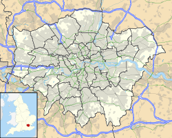
Putney Vale est un quartier de la banlieue sud de Londres localisé dans le district de Wandsworth.
S'y trouve notamment un cimetière, le Putney Vale Cemetery (Stag Lane, Putney - SW15 3DZ), où reposent quelques défunts célèbres, dont Howard Carter (un des découvreurs de la tombe de Toutankhamon).
Wikimedia Foundation.
2010.
Contenu soumis à la licence CC-BY-SA. Source : Article Putney Vale de Wikipédia en français (auteurs)
Regardez d'autres dictionnaires:
Putney Vale — is a small community at the foot of Roehampton Vale, just off the A3. It is part of the Roehampton Ward of the London Borough of Wandsworth.The area is bordered by:* Roehampton * Putney * Kingston * Richmond Park * Wimbledon CommonGeographically … Wikipedia
Putney Vale Cemetery — and Crematorium in London is surrounded by Wimbledon Common and Richmond Park, and is located within forty seven acres of parkland. The cemetery was opened in 1891 and the crematorium in 1938. The cemetery was originally laid out on land which… … Wikipedia
Putney Heath — Administration District londonien : Wandsworth Comté : Greater London Région : London … Wikipédia en Français
Putney — infobox UK place country = England map type = Greater London region= London population= official name= Putney latitude= 51.4649 longitude= 0.2211 london borough= Wandsworth constituency westminster= Putney post town= LONDON postcode area= SW… … Wikipedia
Putney — Nine Elms La gare de Putney. Géographie Pays … Wikipédia en Français
Putney Heath — London Borough of Wandsworth Lage in Greater London Status London Borough Region … Deutsch Wikipedia
Kenelm Lee Guinness — Infobox Person name = Kenelm Edward Bill Lee Guinness image size = caption = birth name = birth date = birth date|1887|08|14|df=yes birth place = Dublin, Ireland cite web title=Kenelm Lee Guinness url=http://www.findagrave.com/cgi bin/fg.cgi?page … Wikipedia
London Borough of Wandsworth — Infobox London Borough | name = London Borough of Wandsworth short name = Wandsworth imagename = status = London borough | area rank = 331st area km2 = 34.26 ons code = 00BJ | adminhq = Wandsworth | ethnicity = 78.0% White 9.6% African Caribbean… … Wikipedia
John Henry Walsh — FRCS (21 October, 1810 12 February, 1888), English writer on sport under the pseudonym of Stonehenge , was born at Hackney, London.He was educated at private schools, and became a fellow of the Royal College of Surgeons in 1844. For several years … Wikipedia
Nine Elms — London borough Wandsworth Ceremonial county Greater London Region London Country England Sov … Wikipedia
 Royaume-Uni