Opglabbeek
- Opglabbeek
-
 Opglabbeek Opglabbeek |
|
|
|
|
|
| Géographie |
| Pays |
 Belgique Belgique |
| Région |
 Région flamande Région flamande |
| Communauté |
Communauté flamande |
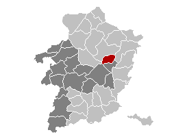
| Province |
 Province de Limbourg Province de Limbourg |
| Arrondissement |
Hasselt |
| Coordonnées |
51° 02′ 00″ N 5° 35′ 00″ E / 51.033333333333, 5.583333333333351° 02′ 00″ Nord
5° 35′ 00″ Est / 51.033333333333, 5.5833333333333 |
Superficie
– Surface agricole
– Bois
– Terrains bâtis
– Divers |
24,98 km² (2005)
33,37 %
23,69 %
27,62 %
15,32 % |
| Données sociologiques |
Population
– Hommes
– Femmes
Densité |
9 807 (1er janvier 2008)
50,49 %
49,51 %
393 hab./km² |
Pyramide des âges
– 0–17 ans
– 18–64 ans
– 65 ans et + |
(1er janvier 2008)
21,59 %
65,56 %
12,86 % |
| Étrangers |
5,46 % (1er janvier 2008) |
| Économie |
| Taux de chômage |
6,52 % (janvier 2009) |
| Revenu annuel moyen |
13 260 €/hab. (2005) |
| Politique |
| Bourgmestre |
Benny Spreeuwers (CD&V) |
| Majorité |
CD&V |
Sièges
CD&V
Pro |
21
19
2 |
| Sections de commune |
| Section |
Code postal |
| Opglabbeek |
3660 |
| Autres informations |
| Gentilé |
(inconnu) |
| Zone téléphonique |
089 |
| Code INS |
71047 |
| Site officiel |
www.opglabbeek.be |
modifier  |
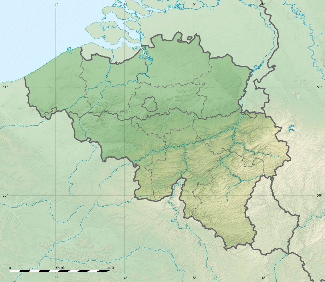
Opglabbeek est une commune néerlandophone de Belgique située en Région flamande dans la province de Limbourg.
Au 1er juillet 2004, la population totale de cette commune est de 9.352 habitants (4.718 hommes et 4.634 femmes). La superficie totale est de 24,98 km².
Évolution démographique depuis 1806

Source:INS
Liens externes
Catégorie : - Commune de la province de Limbourg
Wikimedia Foundation.
2010.
Contenu soumis à la licence CC-BY-SA. Source : Article Opglabbeek de Wikipédia en français (auteurs)
Regardez d'autres dictionnaires:
Opglabbeek — Opglabbeek … Deutsch Wikipedia
Opglabbeek — Flag … Wikipedia
Opglabbeek — es una municipalidad en la provincia belga de Limburgo. En enero de 2011, la población era de 10.135 habitantes, en un área total de 24,98 km² Enlaces externos Sitio oficial, sólo disponible en Flamenco Categoría: Localidades de Bélgica … Wikipedia Español
Opglabbeek — Original name in latin Opglabbeek Name in other language Opglabbeek State code BE Continent/City Europe/Brussels longitude 51.04258 latitude 5.58346 altitude 72 Population 9452 Date 2011 02 28 … Cities with a population over 1000 database
Opglabbeek — Sp Òpglabekas Ap Opglabbeek flamandiškai (olandų k. tarme) L Belgija … Pasaulio vietovardžiai. Internetinė duomenų bazė
Opglabbeek Formation — The Opglabbeek Formation is a geologic formation in the subsurface of the eastern part of Belgian Limburg. The formation consists of lagoonal and fluvial clay and sand and was deposited during the early Selandian (Middle Paleocene, about 60… … Wikipedia
B&B Bed and Beyond — (Opglabbeek,Бельгия) Категория отеля: 4 звездочный отель Адрес: Vinkenkantstraat … Каталог отелей
B&B Le Petit Chateau — (Opglabbeek,Бельгия) Категория отеля: Адрес: Weg naar Bree 1, 3660 Opglabbeek … Каталог отелей
Robert Grondelaers — (born February 28, 1933 in Opglabbeek ndash; died August 22, 1989 in Opglabbeek) was a road cyclist from Belgium, who won the silver medal in the men s individual road race at the 1952 Summer Olympics in Helsinki, Finland. At the same tournament… … Wikipedia
BE-VLI — Provinz Limburg Limburg (nl) Region … Deutsch Wikipedia


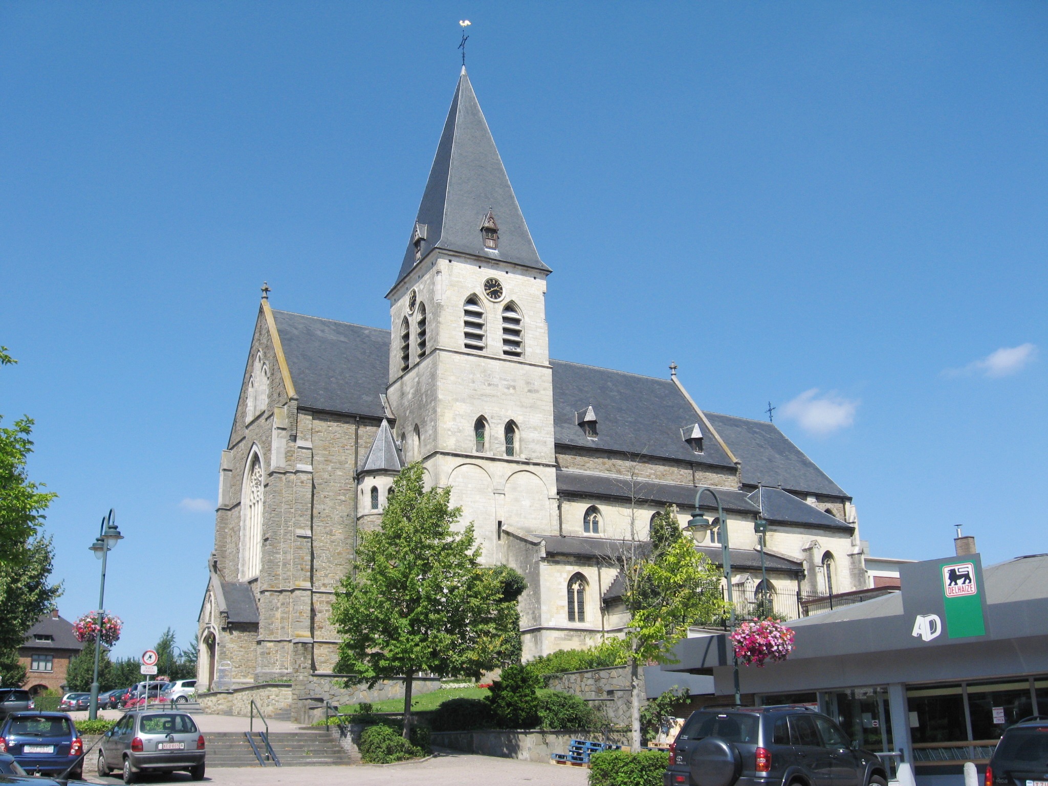
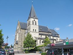 Église Saint-Lambert