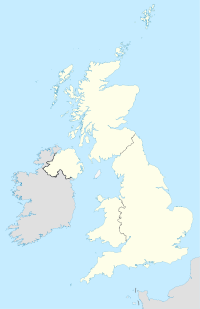
Newport Pagnell
Contenu soumis à la licence CC-BY-SA. Source : Article Newport Pagnell de Wikipédia en français (auteurs)
Regardez d'autres dictionnaires:
Newport-Pagnell — (spr. njūpōrt päggnel), Stadt in Buckinghamshire (England), am Ouse, 21 km östlich von Buckingham, hat eine gotische Kirche (14. Jahrh.), Brauerei, Papiermühle, Spitzenklöppelei und (1901) 4028 Einw. N. ist nach der Familie Paganell benannt.… … Meyers Großes Konversations-Lexikon
Newport Pagnell — (spr. njúhpohrt päggnell), Stadt in der engl. Grafsch. Buckingham, (1901) 4028 E … Kleines Konversations-Lexikon
Newport Pagnell — Coordinates: 52°05′13″N 0°43′19″W / 52.087°N 0.722°W / 52.087; 0.722 … Wikipedia
Newport Pagnell — Basisdaten Land: Großbritannien Landesteil: England Region: Südostengland Borough: Milton Keynes … Deutsch Wikipedia
Newport Pagnell — Original name in latin Newport Pagnell Name in other language Newport Pagnell State code GB Continent/City Europe/London longitude 52.08731 latitude 0.72218 altitude 63 Population 15067 Date 2011 07 31 … Cities with a population over 1000 database
Newport Pagnell Canal — Newport Pagnall Canal The Wharf at Great Linford. The canal passed between the building and the wall on the left. Date of act 1814 … Wikipedia
Newport Pagnell services — County Buckinghamshire Road M1 Coordinates … Wikipedia
Newport Pagnell Town F.C. — Newport Pagnell Town Full name Newport Pagnell Town Football Club Nickname(s) The Swans Founded 1963 (as Newport Pagnell Wanderers) … Wikipedia
Newport Pagnell railway station — Newport Pagnell Location Place Newport Pagnell Grid reference SP871435 … Wikipedia
Newport Pagnell Rural District — Coordinates: 52°05′12″N 0°43′20″W / 52.0866°N 0.7222°W / 52.0866; 0.7222 … Wikipedia
 Angleterre
