Neilston
- Neilston
-
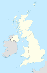
Neilston est un village de l'East Renfrewshire en Écosse. Il se trouve dans la vallée de Levern, à 3,2 km au sud-ouest de Barrhead, à 9,2 km au sud-sud-ouest de Renfrew et à 6,1 km au sud de Paisley, et enfin à la limite sud-ouest de la plus grande conurbation de Glasgow.
Wikimedia Foundation.
2010.
Contenu soumis à la licence CC-BY-SA. Source : Article Neilston de Wikipédia en français (auteurs)
Regardez d'autres dictionnaires:
Neilston — NEILSTON, a parish, in the Upper ward of the county of Renfrew; containing, with the villages of West Arthurlee, Crofthead, Gateside, and Uplamuir, part of the late quoad sacra district of Levern, and the late quoad sacra district of Barrhead … A Topographical dictionary of Scotland
Neilston — (spr. Nihlst n), Kirchspiel in der schottischen Grafschaft Renfrew; 10,000 Ew … Pierer's Universal-Lexikon
Neilston — (spr. nīlst n), Stadt in Renfrewshire (Schottland), am Severn, 3 km südwestlich von Barrhead, mit (1891) 2113 Einw. In der Umgegend viele Baumwollspinnereien und Druckereien … Meyers Großes Konversations-Lexikon
Neilston — (spr. nihlst n) Stadt in der schott. Grafsch. Renfrew, (1901) 13.714 E … Kleines Konversations-Lexikon
Neilston — Coordinates: 55°47′05″N 4°25′24″W / 55.784663°N 4.423396°W / 55.784663; 4.423396 … Wikipedia
Neilston — Original name in latin Neilston Name in other language Baile Neill, Baile Nill, Neilston, Neilstoun, nylstn State code GB Continent/City Europe/London longitude 55.78574 latitude 4.42637 altitude 136 Population 5091 Date 2013 07 11 … Cities with a population over 1000 database
Neilston railway station — Neilston Location Place Ne … Wikipedia
Neilston Juniors F.C. — Neilston Juniors Full name Neilston Juniors Football Club Nickname(s) The Farmer s Boys Founded 1945 Ground Brig O Lea Stadium, Main Street Neilston (Capacity: 2,000) … Wikipedia
Neilston Low railway station — Neilston Low Location Place Neilston Area Renfrewshire Operations Original company Glasgow, Barrhead and Neilston Direct Railway … Wikipedia
Caldwell, East Renfrewshire — Caldwell is a mansion and old estate with the remains of a castle nearby. These lands lie close to the Lugton Water and the villages of Uplawmoor in East Renfrewshire and Lugton in East Ayrshire. History Caldwell Castle and tower The Caldwell… … Wikipedia
 Écosse
