Nantau

Nantau

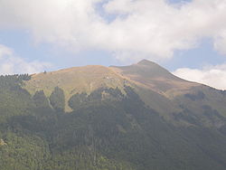
Pointe de Nantaux

Pointe de Nantaux
Pointe de Nantaux.JPG
Géographie
Altitude 2 170 m
Massif Massif du Chablais
Longueur  km
Largeur  km
Superficie  km2
Coordonnées 46° 13′ 33″ Nord
       6° 42′ 29″ Est
/ 46.22583, 6.70806
46°13′33″N 6°42′29″E / 46.22583, 6.70806
Administration
Pays France France
Région Rhône-Alpes
Département Haute-Savoie
Géologie
Âge
Roches
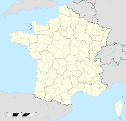
  Géolocalisation sur la carte : France
France location map-Regions and departements.svg
Pointe de Nantaux

La pointe de Nantaux ou pointe d'Hauto est une montagne de Haute-Savoie, dans le massif du Chablais, qui culmine à 2 170 mètres d'altitude. Elle domine la vallée d'Aulps, la commune de Montriond et le lac de Montriond.

  • Portail de la montagne Portail de la montagne
  • Portail de la Savoie Portail de la Savoie
Ce document provient de « Pointe de Nantaux ».

Wikimedia Foundation. 2010.

Contenu soumis à la licence CC-BY-SA. Source : Article Nantau de Wikipédia en français (auteurs)

Игры ⚽ Нужен реферат?

Regardez d'autres dictionnaires:

  • Nantou, Shenzhen — Nantou (also transliterated as Nantau or Nam Tau) (南頭) is an area at the back of Nantau Peninsula in Guangdong, China.It was formerly a walled city facing Tai Shan Bay for coastal defense in Bao an County and now is the capital city of the… …   Wikipedia

  • Nantou, Shenzhen (historical) — Nantou (also transliterated as Nantau or Nam Tau) (南頭) is an area at the back of Nantau Peninsula in Guangdong, China. It was formerly a walled city facing Tai Shan Bay for coastal defense in Bao an County and now is the capital city of the… …   Wikipedia

  • Deep Bay, Hong Kong — Traditional Chinese 后海灣 Simplified Chinese 后海湾 …   Wikipedia

Share the article and excerpts

Direct link
Do a right-click on the link above
and select “Copy Link”