Maasgouw
- Maasgouw
-
| Maasgouw |
|
|
|
| Administration |
| Pays |
 Pays-Bas Pays-Bas |
| Province |
Limbourg |
| Code postal |
6017, 6019, 6050-6051, 6067, 6097, 6099, 6107, 6109 |
| Géographie |
| Coordonnées |
51° 09′ 00″ N 5° 53′ 00″ E / 51.15, 5.88333351° 09′ 00″ Nord
5° 53′ 00″ Est / 51.15, 5.883333 |
|
| Superficie |
5 812 ha = 58,12 km2 |
| - Terre |
4 647 ha = 46,47 km2 |
| - Eau |
1 165 ha = 11,65 km2 |
| Démographie |
| Population |
environ 24 600 hab. |
| Localisation |

|
|
|
modifier  |
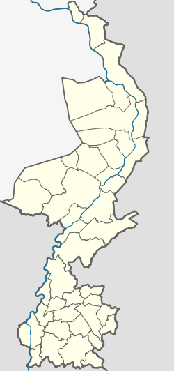
La commune de Maasgouw est une commune des Pays-Bas de la province du Limbourg néerlandais.
Maasgouw a été créée le 1er janvier 2007 par la fusion des communes de Heel, de Maasbracht, et de Thorn.
Localités
Beegden, Brachterbeek, Heel, Linne, Maasbracht, Ohé en Laak, Panheel, Stevensweert, Thorn et Wessem.
Lien externe
Wikimedia Foundation.
2010.
Contenu soumis à la licence CC-BY-SA. Source : Article Maasgouw de Wikipédia en français (auteurs)
Regardez d'autres dictionnaires:
Maasgouw — Gemeinde Maasgouw Flagge Wappen Provinz Limburg Bürgermeister … Deutsch Wikipedia
Maasgouw — Infobox Settlement name =PAGENAME official name = other name = native name = nickname = settlement type = total type = motto = imagesize = image caption = flag size = image seal size = image shield = shield size = image blank emblem = blank… … Wikipedia
Linne (Maasgouw) — Linne Linne ist ein Dorf in der niederländischen Provinz Limburg und gehört zur Gemeinde Maasgouw. Der Ort liegt zwischen Roermond und Maasbracht an der Maas. Geschichte Das Dorf wurde erstmals im Jahr 943 urkundlich erwähnt. Von 1991 bis 2007… … Deutsch Wikipedia
Gemeente Maasgouw — Admin ASC 2 Code Orig. name Gemeente Maasgouw Country and Admin Code NL.05.1641 NL … World countries Adminstrative division ASC I-II
Stevensweert — Gemeinde Maasgouw Flagge Wappen Provinz … Deutsch Wikipedia
Wessem — Gemeinde Maasgouw Flagge Wappen Provinz … Deutsch Wikipedia
Kasteel Erenstein — (Schloss Ehrenstein, Oud Ehrenstein) ist eine Burg aus dem 13. Jahrhundert in Kerkrade im Südosten der niederländischen Provinz Limburg. Kasteel Erenstein liegt im so genannten Anstelvallei (Amsteltal) unmittelbar am Anstellerbeek (Amstelbach).… … Deutsch Wikipedia
Heel (Limbourg néerlandais) — 51°10′50″N 5°53′45″E / 51.18056, 5.89583 … Wikipédia en Français
Maasbracht — 51°8′31″N 5°53′23″E / 51.14194, 5.88972 … Wikipédia en Français
Thorn (Limbourg néerlandais) — 51°9′49″N 5°50′26″E / 51.16361, 5.84056 … Wikipédia en Français


 Pays-Bas


