Lütschental

Lütschental
Lütschental
Une vue d'ensemble de la commune serait la bienvenue
Administration
Pays Suisse Armoiries de la commune.
Canton Berne
Arrondissement Interlaken-Oberhasli
Langue Allemand
N° OFS 0586
Code postal 3816
Site Web www.luetschental.ch
Géographie
Superficie 12,35 km²[1]
Altitude 714
Coordonnées 46° 38′ 00″ N 7° 57′ 00″ E / 46.633332, 7.94999946° 38′ 00″ N 7° 57′ 00″ E / 46.633332, 7.949999 
Démographie
Population 240 (31 décembre 2009)[2]
Densité 19,4 hab./km²
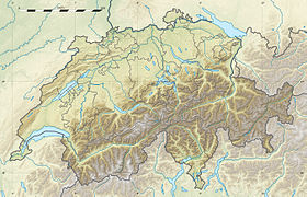
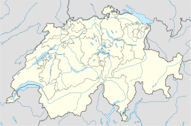
Localisation

Localisation de Lütschental en Suisse.

Lütschental est une commune suisse du canton de Berne, située dans l'arrondissement administratif d'Interlaken-Oberhasli.

Références

  1. Statistique de la superficie 2004/09 : Données communales sur Office fédéral de la Statistique. Consulté le 23 septembre 2010
  2. Bilan de la population résidante permanente (total) selon les districts et les communes, en 2009 sur Office fédéral de la Statistique. Consulté le 1er septembre 2010

Wikimedia Foundation. 2010.

Contenu soumis à la licence CC-BY-SA. Source : Article Lütschental de Wikipédia en français (auteurs)

Игры ⚽ Нужно сделать НИР?

Regardez d'autres dictionnaires:

  • Lütschental — Basisdaten Staat: Schweiz …   Deutsch Wikipedia

  • Lütschental — Escudo …   Wikipedia Español

  • Lutschental — Lütschental Lütschental Une vue d ensemble de la commune serait la bienvenue Administration Pays Suisse …   Wikipédia en Français

  • Lütschental — Lütschental, s. Grindelwald …   Meyers Großes Konversations-Lexikon

  • Lütschental — Infobox Swiss town subject name = Lütschental municipality name = Lütschental municipality type = municipality imagepath coa = |pixel coa= languages = German canton = Berne iso code region = CH BE district = Interlaken lat d=46|lat m=38|lat… …   Wikipedia

  • Lutschental railway station — Infobox Station name= Lutschental type= regional rail image caption= address= coordinates= line= Berner Oberland Bahn other= structure= platform= 1 levels= tracks= parking= bicycle= baggage check= passengers= pass year= pass percent= pass system …   Wikipedia

  • Bahnhof Burglauenen — Berner Oberland Bahn Zug in Interlaken Fahrplanfeld: 311, 312 Streckenlänge: 23.69 km Spurweite: 1000 mm (Meterspur) Strom …   Deutsch Wikipedia

  • Berner-Oberland-Bahnen — Berner Oberland Bahn Zug in Interlaken Fahrplanfeld: 311, 312 Streckenlänge: 23.69 km Spurweite: 1000 mm (Meterspur) Strom …   Deutsch Wikipedia

  • Zweilütschinen — Gündlischwand Basisdaten Kanton: Bern Amtsbezirk: Interlaken …   Deutsch Wikipedia

  • Berner Oberland-Bahn — Zug in Interlaken Fahrplanfeld: 311, 312 Streckenlänge: 23.69 km Spurweite: 1000 mm …   Deutsch Wikipedia

Share the article and excerpts

Direct link
Do a right-click on the link above
and select “Copy Link”