Loikaw
- Loikaw
-
Loikaw, ou Loi-kaw (birman : လ္ဝုိင္ေကာ္မ္ရုိ့, transcrit lwing kaw mrui) est la capitale de l'État de Kayah, en Birmanie. Elle est située dans le nord de l'état, à une altitude de 1 200 m et compte environ 11 000 habitants, pour la plupart d'ethnie Karenni. Le plus grand barrage hydroélectrique de Birmanie (180 MW), construit par les japonais à titre de réparation pour les dommages de la Seconde Guerre mondiale, se trouve à 20 km à l'Est de Loikaw, aux chutes de Lawpita.
Transport
Loikaw se trouve au terminus de la nouvelle ligne ferroviaire Aungban-Pinlong-Loikaw.
Éducation
La ville possède une université.
Lien externe
19°40′27″N 97°12′33″E / 19.67417, 97.20917
Wikimedia Foundation.
2010.
Contenu soumis à la licence CC-BY-SA. Source : Article Loikaw de Wikipédia en français (auteurs)
Regardez d'autres dictionnaires:
Loikaw — or Loi kaw (MYname|MY=လွိုင်ကော်မြို့|MLCTS=lwing kaw mrui.; population estimate 11,000) is the capital of Kayah State in Myanmar (Burma). It is located near the State s northern tip, at an elevation of 1,200 meters. The inhabitants are mostly… … Wikipedia
Loikaw — o Loi kaw (población aproximada 11.000 habitantes) es la capital del estado de Kayah, en Birmania. Se encuentra cerca del extermo septentrional del estado, a una altitud de 1.200 msnm. La mayor parte de sus habitantes pertenece a la etnia… … Wikipedia Español
Loikaw — [ lɔɪkɔː], Hauptstadt des Kayahstaates, Ostbirma; Seidenweberei, Sägewerk. Nahebei das größte Wasserkraftwerk Birmas (über 100 000 kW Leistung) … Universal-Lexikon
Loikaw — Original name in latin Loikaw Name in other language LIW, Loikaw, Lwegaw, Lwgaw State code MM Continent/City Asia/Rangoon longitude 19.67798 latitude 97.20975 altitude 893 Population 17293 Date 2012 12 06 … Cities with a population over 1000 database
Loikaw — Lage von Loi kaw im Kayah Staat Loi kaw (auch Loikaw) ist die Hauptstadt des Kayah Staats im Osten von Myanmar an der Grenze zu Thailand. Die Stadt liegt in 1200 m Höhe und hat ca. 11.000 Einwohner. Sie ist mit der Außenwelt über einen Flugplatz… … Deutsch Wikipedia
Loikaw Township — is a township of Loikaw District in the eastern part of Kayah State in Myanmar.The principal town lies at Loikaw … Wikipedia
Loikaw District — is a district of the Kayah State in eastern part of Myanmar.TownshipsThe district contains the following townships:*Loikaw Township *Demoso Township *Hpruso Township *Shadaw Township … Wikipedia
Loikaw Airport — Infobox Airport name = Loikaw Airport nativename = nativename a = nativename r = image width = caption = IATA = LIW ICAO = VYLK type = owner = operator = city served = location = Loikaw, Burma elevation f = 2940 elevation m = 896 coordinates =… … Wikipedia
Loikaw District — Admin ASC 2 Code Orig. name Loikaw District Country and Admin Code MM.06.8238713 MM … World countries Adminstrative division ASC I-II
Loikaw — The capital of Kayah State; its population was estimated at 48,017 in 1996. Located at an elevation of 1,200 meters, it remains largely off limits to visitors. Nearby is the Baluchaung Hydroelectric plant, built with Japanese war reparations,… … Historical Dictionary of Burma (Myanmar)
 Birmanie
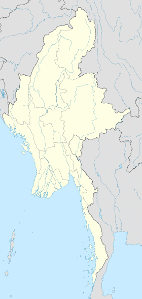
 Loikaw