- Kostiantynivka
-
Kostiantynivka Костянтинівка 

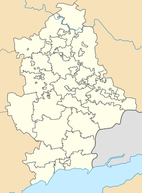
Géolocalisation sur la carte : Oblast de Donetsk

Géolocalisation sur la carte : Ukraine
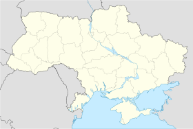
Coordonnées : Pays  Ukraine
Subdivision  Oblast de Donetsk
Maire Sergei Davydov Fondation 1870 Statut Ville depuis 1932 Population  80 416 hab. (2010)
Densité 1 218 hab./km² Altitude 86 m Superficie 66,04 km2 Indicatif tél. +380 6272 Code postal 85100 — 85129 Liste des villes d'Ukraine | Carte Kostiantynivka (en ukrainien : Костянтинівка) ou Konstantinovka (en russe : Константиновка) est une ville industrielle de l'oblast de Donetsk, en Ukraine, et le centre administratif du raïon de Kostiantynivka. Sa population s'élevait à 80 416 habitants en 2010.
Sommaire
Géographie
Kostiantynivka est située sur la rivière Krivyï Torets, à 58 km au nord de Donetsk.
Histoire
Kostiantynivka a été fondée en 1812 par un grand propriétaire foncier, Nomikossov, en l’honneur de son fils aîné, Kostiantyn. Au début du XXe siècle, la localité se transforme en une cité industrielle. Elle reçoit le statut de commune urbaine en 1926 et le statut de ville en 1932. Pendant l'ère soviétique, Kostiantynivka devient un centre majeur de la métallurgie du fer et du zinc ainsi que de la fabrication du verre.
Population
Recensements (*) ou estimations de la population [1] :
Évolution démographique 1926* 1933 1939* 1959* 1970* 1979* 1989* 25 000 84 200 95 100 89 000 106 000 112 020 107 562 2001* 2005 2006 2007 2008 2009 2010 95 111 88 833 86 828 84 970 82 845 81 434 80 416 Liens externes
- (ru) Konstantinovka - Votre ville!
- (uk) Informations officielles
- (ru) Cartes topographiques
- (uk) Carte routière
Notes et références
- (en) World Gazetteer [1] — (uk) Comité d'État de statistiques d'Ukraine : Статистичний збірник «Чисельність наявного населення України на 1 січня 2008 року» [Manuel statistique « Nombre d'habitants de l'Ukraine au 1er janvier 2008 »]. [2] ; «Статистичний збірник "Чисельність наявного населення України на 1 січня 2010 року» [Manuel statistique « Nombre d'habitants de l'Ukraine au 1er janvier 2010 »]. [3]
Catégories :- Ville d'Ukraine
- Ville de l'oblast de Donetsk


Wikimedia Foundation. 2010.