Kondrovo

Kondrovo
Kondrovo
Кондрово
Coordonnées : 54°48′N 35°59′E / 54.8, 35.98354°48′N 35°59′E / 54.8, 35.983
  Géolocalisation sur la carte : Russie
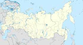
Russia edcp location map.svg
Kondrovo
Pays Drapeau de Russie Russie
Région économique Centre
District fédéral Central
Sujet fédéral Flag of Kaluga Oblast.svg Oblast de Kalouga
Code OKATO 29 208 501
Maire Andreï Leonidovitch Komarov
Fondation 1613
Statut Ville depuis 1938
Population en augmentation 16 927 hab. (2008)
Densité 891 hab./km2
Altitude 150 m
Superficie 19 km2
Fuseau horaire UTC+4 (MSK/MSD)
Heure de Moscou
Indicatif téléphonique (+7) 48434
Code postal 249830–249834
Liste des villes de Russie

Modèle:Infobox Ville de Russie/Blason manquant

Kondrovo (en russe : Кондрово) est une ville de l'oblast de Kalouga, en Russie, et le centre administratif du raïon de Dzerjinski. Elle est située sur la rivière Chan, un affluent de l'Ougri, à 34 km au nord-ouest de Kalouga. Sa population s'élève à 16 927 habitants en 2008.

Sommaire

Histoire

L'origine de la ville remonte à 1613. En 1790, une papeterie fut construite dans le village de Kondrovo et à la fin du XIXe siècle elle était célèbre pour la haute qualité de son papier. Kondrovo a le statut de ville depuis 1938.

Population

Évolution démographique
1959 1970 1979 1989 2002 2008
13 100 15 700 15 100 17 200 17 177 16 927

Économie

La principale entreprise de la ville est la société Kodrovskaïa Boumajnaïa Kompaniia ou KBK (en russe : Кодровская бумажная компания ou КБК), qui fabrique du parchemin, du papier-toilette, des carnets, des articles d'hygiène féminine.

Source


Armoiries de l'oblast de Kalouga Villes de l'oblast de Kalouga Drapeau de l'oblast de Kalouga
Capitale administrative : Kalouga

Balabanovo • Beloussovo • Borovsk • Iermolino • Ioukhnov • Jizdra • Joukov • Kirov • Kondrovo • Kozelsk • Kremionki • Lioudinovo • Maloïaroslavets • Mechtchovsk • Medyne • Mossalsk • Obninsk • Sossenski • Soukhinitchi • Spas-Demensk • Taroussa


Wikimedia Foundation. 2010.

Contenu soumis à la licence CC-BY-SA. Source : Article Kondrovo de Wikipédia en français (auteurs)

Игры ⚽ Поможем написать курсовую

Regardez d'autres dictionnaires:

  • Kondrovo — ( ru. Кондрово) is a town and the administrative center of Dzerzhinsky District of Kaluga Oblast, Russia, located on the Shanya River (a tributary of the Ugra in the Oka s basin), some km to mi|40 north west of Kaluga. Population: 16,900 (2005… …   Wikipedia

  • Kondrovo — Original name in latin Kondrovo Name in other language KONDROVO, Kondrova, Kondrovo, Troitskoye, КОНДРОВО, Кондрово State code RU Continent/City Europe/Moscow longitude 54.80639 latitude 35.92778 altitude 152 Population 17151 Date 2012 01 17 …   Cities with a population over 1000 database

  • Kondrovo — Stadt Kondrowo Кондрово Föderationskreis Zentralrussland Oblast …   Deutsch Wikipedia

  • List of cities and towns in Russia — This is a list of cities and towns in Russia. According to the data of 2002 Russian Census, there are 1,108 cities and towns in Russia. City Russian name Federal subject Abakan Абакан Republic of Khakassia Abaza Абаза Republic of Khakassia… …   Wikipedia

  • Aleksandr Khinchin — Aleksandr Yakovlevich Khinchin (Russian Александр Яковлевич Хинчин, French Alexandre Khintchine) (July 19,1894 – November 18, 1959) was a Russian mathematician and one of the most significant people in the Soviet school of probability theory. He… …   Wikipedia

  • Obninsk — Coordinates: 55°5′35″N 36°36′38″E / 55.09306°N 36.61056°E / 55.09306; 36.61056 …   Wikipedia

  • Maloyaroslavets — Coordinates: 55°01′N 36°28′E / 55.017°N 36.467°E / 55.017; 36.467 …   Wikipedia

  • Administrative divisions of Kaluga Oblast — *Cities and towns under the oblast s jurisdiction: **Kaluga (Калуга) (administrative center) *** city okrugs : ****Leninsky (Ленинский) *****with 3 rural okrugs under the city okrug s jurisdiction. ****Moskovsky (Московский) *****with 3 rural… …   Wikipedia

  • Mosalsk — Coordinates: 54°29′N 34°59′E / 54.483°N 34.983°E / 54.483; 34.983 …   Wikipedia

  • Meshchovsk — Coordinates: 54°19′28″N 35°16′51″E / 54.32444°N 35.28083°E / 54.32444; 35.28083 …   Wikipedia

Share the article and excerpts

Direct link
Do a right-click on the link above
and select “Copy Link”