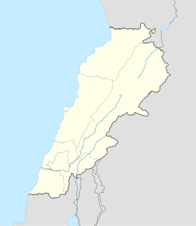
Kfardebian
- Kfardebian
-
Faraya Mzaar Kfardebian
Faraya Mzaar Kfardebian ou Faraya-Mzaar (en arabe : فرايا مزار), également connu sous le nom de Ouyoune el Simaan ou Aayoun Al Simane est un domaine skiable, le plus haut du Kesrouan, situé à une altitude comprise entre 1600 et 2800 mètres d´altitude, à 44 kilomètres de Beyrouth et a 27 de Jounieh.
Kfardebian
Le village de Kfardebian compte 12 000 habitants. Il est connu pour ses produits agricoles et son miel et ses sources naturelles (El Laban de Nebaa et EL-Assal de Nebaa)
Le nom, d'origine sémitique et dérivant du syriaque, signifie « le village des daims ». Kfardebiane est devenu dans l'âge moderne le centre de l'état du Al-Jird pendant la période de Moutassarifiya (1860-1914). En 1900 la première municipalité de l´état du Kesrouan a été établie dans ce village.
Voir aussi
Liens externes
 Portail des sports d’hiver
 Portail du Liban
Catégories : Ville du Liban | Ski au Liban
Wikimedia Foundation.
2010.
Contenu soumis à la licence CC-BY-SA. Source : Article Kfardebian de Wikipédia en français (auteurs)
Regardez d'autres dictionnaires:
Faraya Mzaar Kfardebian — Faraya is a Lebanese village located in Kisrwan, at an altitude of 1350 m above sea level. The village of Faraya is a populated village with residents that stay there in summer as well as in winter, in spite of the harsh weather in winter. Above… … Wikipedia
Faraya Mzaar Kfardebian — Faraya Mzaar (ar) فرايا مزار Administration Pays … Wikipédia en Français
Faraya — Mzaar Kfardebian Faraya Mzaar (ar) فرايا مزار Administration Pays … Wikipédia en Français
District de Kesrouan — (قضاء كسروان) Carte de localisation du district. Administration Pays … Wikipédia en Français
List of Lebanon-related articles — NOTOC Articles (arranged alphabtically) related to or originating from Lebanon, including people, places, things, and concepts, are: 0 9 1948 Arab Israeli War UN resolutions 425 1559 1583 1701 A AbdelMalak, Samir Abu Nidal Organization Achrafieh… … Wikipedia
Keserwan District — Infobox Settlement name =Keserwan District settlement type =District official name =قضاء كسروان nickname = motto = imagesize = 300px image caption = Jounieh Bay flag size = image seal size = image shield = shield size = image blank emblem = blank … Wikipedia
List of ski areas and resorts in Asia — This is a list of ski areas and resorts in Asia. Armenia*Tsakhkadzor ski resortChina*Yabuli Ski Resort, Heilongjiang *Beidahu, Jilin *Songhuahu, Jilin *Nanshan Ski Village, Beijing *Wanlong Ski Resort, Hebei *Yulongxueshan, Yunnan *Xiling Snow… … Wikipedia
Tourism in Lebanon — The tourism industry in Lebanon has been historically important to the local economy and remains to this day to be a major source of revenue for Lebanon. Before the Lebanese Civil War, Lebanon was widely regarded as, The Switzerland of the Middle … Wikipedia
Skiing in Lebanon — Skiing in Lebanon, introduced to the country in the early 20th century, has become increasingly popular. The Mount Lebanon range in Lebanon, occasionally referred to as the Switzerland of the Middle East , is home to six ski resorts. [cite… … Wikipedia
Kesrouan — District de Kesrouan Le Kesrouan est un des cazas (divisions administratives) de la subdivision du Mont Liban au Liban. Il se situe dans la partie centrale du pays, un peu au nord de Beyrouth, entre la mer Méditerranée et le Mont Liban et son… … Wikipédia en Français
 Liban
Liban
