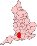
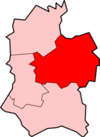
Kennet (district)
Contenu soumis à la licence CC-BY-SA. Source : Article Kennet (district) de Wikipédia en français (auteurs)
Regardez d'autres dictionnaires:
Kennet (district) — Kennet is a local government district in Wiltshire, England. Its council is based in Devizes. It is named after the River Kennet.The district was formed on April 1, 1974, under the Local Government Act 1972, by a merger of the municipal boroughs… … Wikipedia
Kennet — peut faire référence à : Lieux Kennet (district), un ancien district de gouvernement local, dans le Wiltshire, en Angleterre Kennet, Clackmannanshire, Écosse Kennet (Prison), une prison de Liverpool, en Angleterre Kennet School, une école de … Wikipédia en Français
Kennet — ▪ district, England, United Kingdom district, administrative and historic county of Wiltshire, southern England, in the east central part of the county, about midway between Bristol and London. Kennet is a rural district of rolling chalk… … Universalium
Kennet — District Lage in Wiltshire Status District Region South West England Verw.grafschaft Wiltshire … Deutsch Wikipedia
Kennet — may refer to:*Kennet (district), a local government district in Wiltshire *Kennet School, a school in Thatcham *River Kennet, a tributary of the Thames *Kennet and Avon Canal, a canal in southern England *Kennet Partners, a private equity firm… … Wikipedia
Kennet School — Infobox UK school name = Kennet Comprehensive School |The badge of Kennet Comprehensive School size = 150px latitude = 51.4015 longitude = 1.2487 dms = motto = Excellence through endeavour established = 1957 type = Comprehensive community school… … Wikipedia
Charlton, Kennet, Wiltshire — Charlton is a village and civil parish in the Vale of Pewsey in the English county of Wiltshire. On some maps, it is shown as Charlton St. Peter.Local governmentCharlton is grouped with the parish of Wilsford, the two have a joint parish council … Wikipedia
Marlborough and Ramsbury Rural District — Coordinates: 51°25′12″N 1°43′48″W / 51.420°N 1.730°W / 51.420; 1.730 Marlborough and Ramsbury was a rur … Wikipedia
List of District Health Authorities in England and Wales — District Health Authorities were administrative units of the National Health Service in England and Wales from 1982 to 1996. The districts were a second tier below the health regions. They replaced the Area Health Authorities (which generally… … Wikipedia
River Kennet — The upper reaches of the River Kennet near AveburyThe Kennet is a river in the south of England, and a tributary of the River Thames. The lower reaches of the river are navigable to river craft and are known as the Kennet Navigation, which,… … Wikipedia


 Royaume-Uni