Kavilo

Kavilo
Kavilo
Кавило, Rákóczifalu
Administration
Pays Drapeau de Serbie Serbie
Province Voïvodine
Région Bačka
District Bačka septentrionale
Municipalité Bačka Topola
Géographie
Coordonnées 45° 48′ 11″ Nord
       19° 51′ 16″ Est
/ 45.803055, 19.854444
Superficie 3 874 ha = 38,74 km2
Démographie
Population 233 hab. (2002)
Densité 6 hab./km2
Localisation
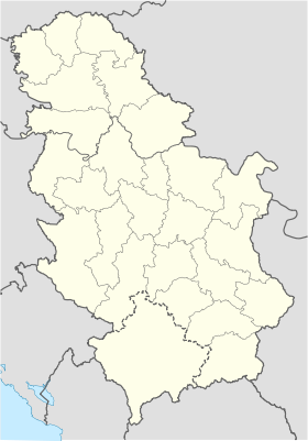
Serbia location map.svg
City locator 14.svg
Kavilo

Kavilo (en serbe cyrillique : Кавило ; en hongrois : Rákóczifalu ou Kavilló) est un village de Serbie situé dans la province autonome de Voïvodine. Il fait partie de la municipalité de Bačka Topola dans le district de Bačka septentrionale. En 2002, il comptait 233 habitants[1], dont 215 Hongrois (92,27 %) et 2 Croates (0,85 %)[2].

Sommaire

Démographie

Évolution démographique
1948 1953 1961 1971 1981 1991 2002
97 229 223 209 276 259 233[1]

Notes et références

  1. a et b (sr) Livre 9, Population, analyse comparative de la population en 1948, 1953, 1961, 1971, 1981, 1991 et 2002, données par localités, Institut de statistique de la République de Serbie, Belgrade, mai 2004 (ISBN 86-84433-14-9)
  2. (sr) Livre 1, Population, origine nationale ou ethnique, données par localités, Institut de statistique de la République de Serbie, Belgrade, février 2003 (ISBN 86-84433-00-9)

Voir aussi

Articles connexes


Wikimedia Foundation. 2010.

Contenu soumis à la licence CC-BY-SA. Source : Article Kavilo de Wikipédia en français (auteurs)

Игры ⚽ Нужно сделать НИР?

Regardez d'autres dictionnaires:

  • Kavilo — (Кавило, Hungarian: Rákóczitelep or Kavilló ) is a village in Serbia. It is situated in the Bačka Topola municipality, in the North Bačka District, Vojvodina province. The village has a Hungarian ethnic majority. Its population was 233 people in… …   Wikipedia

  • Bačka Topola — Бачка Топола Topolya   Municipality and Town   The Catholic church and main street in Bačka Top …   Wikipedia

  • Backa Topola — Bačka Topola Bačka Topola Бачка Топола Topolya [[Image:|100px|center|Drapaeau]] …   Wikipédia en Français

  • Bačka Topola — Бачка Топола, Topolya Héraldique …   Wikipédia en Français

  • Subotica — For other uses, see Subotica (disambiguation). Subotica Суботица Szabadka Subotica City Hall square …   Wikipedia

  • North Bačka District — Severnobački okrug Севернобачки округ Észak bácskai körzet   District of Serbia   Location of North Bačka District in Serbia …   Wikipedia

  • Mali Iđoš — Мали Иђош Kishegyes   Village   Church of Saint Ann …   Wikipedia

  • List of cities, towns and villages in Vojvodina — This is a list of cities, towns and villages in Vojvodina, a province of Serbia. Largest cities of Vojvodina are: Novi Sad (216,583), Subotica (99,981), Zrenjanin (79,773), Pančevo (77,087), Sombor (51,471), Kikinda (41,935), Sremska Mitrovica… …   Wikipedia

  • Donji Tavankut — Subotica Kelebija …   Wikipedia

  • Hungarians in Vojvodina — Vajdasági magyarok Total population …   Wikipedia

Share the article and excerpts

Direct link
Do a right-click on the link above
and select “Copy Link”