Inchmarnock
- Inchmarnock
-
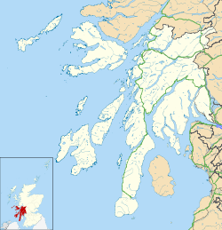
Inchmarnock est une île du Royaume-Uni située en Écosse.
Wikimedia Foundation.
2010.
Contenu soumis à la licence CC-BY-SA. Source : Article Inchmarnock de Wikipédia en français (auteurs)
Regardez d'autres dictionnaires:
Inchmarnock — Inchmarnock, Insel im Clyde Golf in Schottland, westlich von der Insel Bute … Pierer's Universal-Lexikon
Inchmarnock — Infobox Scottish island | latitude=55.79 longitude= 05.16 GridReference=NS020598 celtic name=Innis Mhearnaig norse name= meaning of name=Island of St Marnock area=266 ha area rank=94 highest elevation=60 m Population=0 population rank= main… … Wikipedia
Bute, John Stuart, 3rd Earl of, Viscount Kingarth, Lord Mount Stuart, Cumrae, And Inchmarnock — ▪ prime minister of United Kingdom born May 25, 1713, Edinburgh, Scot. died March 10, 1792, London, Eng. Scottish royal favourite who dominated King George III of Great Britain during the first five years of his reign. As prime minister… … Universalium
HMS Vandal (P64) — was a Royal Navy U class submarine built by Vickers Armstrong at Barrow in Furness, yard number 838. The submarine had the shortest career of any Royal Navy submarine, being lost with all 37 onboard just four days after commissioning. [cite web | … Wikipedia
Île d'Arran — Pour les articles homonymes, voir Arran. Ne doit pas être confondu avec Îles d Aran. Île d Arran Isle of Arran … Wikipédia en Français
Isle of Arran — This article is about the Scottish island. For other uses, see Arran. Isle of Arran Location OS grid reference … Wikipedia
Marquess of Bute — For the Prime Minister, see John Stuart, 3rd Earl of Bute. Marquessate of Bute Creation date 27 February 1796 Created by King George III Peerage Peer … Wikipedia
Firth of Clyde — 55.666666666667 5 Koordinaten: 55° 40′ 0″ N, 5° 0′ 0″ W … Deutsch Wikipedia
Holy Isle (Écosse) — Pour les articles homonymes, voir Holy Isle. Holy Isle Eilean MoLaise (gd) … Wikipédia en Français
Pladda — Géographie Pays Royaume Uni Archipel Îles Britanniques Localisa … Wikipédia en Français
 Royaume-Uni
 Royaume-Uni


