Hosszúpereszteg
- Hosszúpereszteg
-
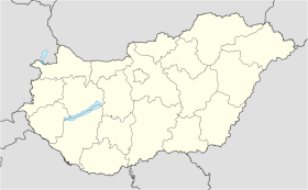
Hosszúpereszteg est un village de Hongrie, situé dans le département de Vas. Lors du recensement de 2004, il y avait 737 habitants.
Wikimedia Foundation.
2010.
Contenu soumis à la licence CC-BY-SA. Source : Article Hosszúpereszteg de Wikipédia en français (auteurs)
Regardez d'autres dictionnaires:
Hosszúpereszteg — Infobox Settlement subdivision type = Country subdivision name = HUN timezone=CET utc offset=+1 timezone DST=CEST utc offset DST=+2|official name=Hosszúpereszteg subdivision type1=County subdivision name1=Vas area total km2=37.01 population total … Wikipedia
Szajki Tavak Apartman Elena Vendégház — (Hosszúpereszteg,Венгрия) Категория отеля: Адрес: 9676 Hosszú … Каталог отелей
Vas County — Infobox Hungarian county name =Vas region =Western Transdanubia seat = Szombathely area = 3336 population = 261,900 density = 78 cities = 216Vas (German: Eisenburg , Slovenian Železna županija ) is the name of an administrative county (comitatus… … Wikipedia
Szentgotthárd — City centre with the Rába River … Wikipedia
Countrywide Blue Tour in Hungary — The route of the Countrywide Blue Tour in Hungary The Countrywide Blue Tour (in Hungarian: Országos Kéktúra, Kéktúra or simply OKT) is a part of the Hungarian section of the European Long Distance Walking Route E4. The route starts atop the… … Wikipedia
Csepreg — Sea … Wikipedia
Őriszentpéter — Coat of arms Country … Wikipedia
Church of St. Stephen Harding in Apátistvánfalva — The Church of St. Stephen Harding in Apátistvánfalva or Apátistvánfalvian Church (Hungarian: Apátistvánfalvai Harding Szent István templom, Slovene: Cerkev Svetega Štefana v Števanovci Prekmurian: Štev … Wikipedia
Kleingebiet Sarvar — Koordinaten fehlen! Hilf mit. Das Kleingebiet Sárvár (ungarisch Sárvári kistérség) ist eine ungarische Verwaltungseinheit (LAU 1) innerhalb des Komitats Vas. Der Verwaltungssitz ist in Sárvár. Gemeinden Bejcgyertyános Bögöt Bögöte Csánig Csénye… … Deutsch Wikipedia
Kleingebiet Sárvár — Das Kleingebiet Sárvár (ungarisch Sárvári kistérség) ist eine ungarische Verwaltungseinheit (LAU 1) innerhalb des Komitats Vas. Der Verwaltungssitz ist in Sárvár. Gemeinden Bejcgyertyános Bögöt Bögöte Csánig Csénye Gérce Hosszúpereszteg Ikervár… … Deutsch Wikipedia
 Hongrie
