Vámoscsalád
- Vámoscsalád
-
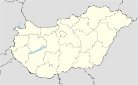
Vámoscsalád est un village et une commune du comitat de Vas en Hongrie.
Géographie
Cette section est vide, insuffisamment détaillée ou incomplète.
Votre aide est la bienvenue !
Histoire
Cette section est vide, insuffisamment détaillée ou incomplète.
Votre aide est la bienvenue !
Catégorie :
- Ville et village du comitat de Vas
Wikimedia Foundation.
2010.
Contenu soumis à la licence CC-BY-SA. Source : Article Vámoscsalád de Wikipédia en français (auteurs)
Regardez d'autres dictionnaires:
Vámoscsalád — is a village in Vas county, Hungary … Wikipedia
Church of St. Stephen Harding in Apátistvánfalva — The Church of St. Stephen Harding in Apátistvánfalva or Apátistvánfalvian Church (Hungarian: Apátistvánfalvai Harding Szent István templom, Slovene: Cerkev Svetega Štefana v Števanovci Prekmurian: Štev … Wikipedia
Bahnstrecke Hegeshalom–Porpác — Hegeshalom–Porpác Kursbuchstrecke: MÁV 70 Streckennummer: 16 Streckenlänge: 94 km Spurweite: 1435 mm (Normalspur) Stromsystem: 25 kV / 50 Hz Höchstgeschwindigkeit: 100 km/h Legende … Deutsch Wikipedia
Bahnstrecke Hegyeshalom–Porpác — Hegyeshalom–Porpác Kursbuchstrecke: MÁV 70 Streckennummer: 16 Streckenlänge: 94 km Spurweite: 1435 mm (Normalspur) Stromsystem: 25 kV / 50 Hz Höchstgeschwindigkeit: 100 km/h … Deutsch Wikipedia
Bahnstrecke Hegyeshalom–Szombathely — Hegeshalom–Porpác Kursbuchstrecke: MÁV 70 Streckennummer: 16 Streckenlänge: 94 km Spurweite: 1435 mm (Normalspur) Stromsystem: 25 kV / 50 Hz Höchstgeschwindigkeit: 100 km/h Legende … Deutsch Wikipedia
Vas County — Infobox Hungarian county name =Vas region =Western Transdanubia seat = Szombathely area = 3336 population = 261,900 density = 78 cities = 216Vas (German: Eisenburg , Slovenian Železna županija ) is the name of an administrative county (comitatus… … Wikipedia
Szentgotthárd — City centre with the Rába River … Wikipedia
Csepreg — Sea … Wikipedia
Őriszentpéter — Coat of arms Country … Wikipedia
Kleingebiet Sarvar — Koordinaten fehlen! Hilf mit. Das Kleingebiet Sárvár (ungarisch Sárvári kistérség) ist eine ungarische Verwaltungseinheit (LAU 1) innerhalb des Komitats Vas. Der Verwaltungssitz ist in Sárvár. Gemeinden Bejcgyertyános Bögöt Bögöte Csánig Csénye… … Deutsch Wikipedia

 Hongrie


