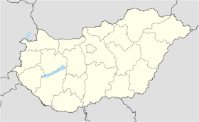
Bucsu
- Bucsu
-
Bucsu est un village de Hongrie, situé dans le département de Vas. Lors du recensement de 2004, il y avait 596 habitants.
Wikimedia Foundation.
2010.
Contenu soumis à la licence CC-BY-SA. Source : Article Bucsu de Wikipédia en français (auteurs)
Regardez d'autres dictionnaires:
Bucsu — Infobox Settlement subdivision type = Country subdivision name = HUN timezone=CET utc offset=+1 timezone DST=CEST utc offset DST=+2|official name=Bucsu subdivision type1=County subdivision name1=Vas area total km2=16.54 population total=596… … Wikipedia
Pinkatalbahn — Friedberg–Szombathely Verlauf Pinkatalbahn Streckenlänge: 68 km Spurweite: 1435 mm (Normalspur) Legende … Deutsch Wikipedia
Markotabödöge — önálló község. Győr Moson Sopron megye északnyugati részén a Tóközben fekszik, közel a Hansághoz. Felszínét mélyebben fekvő területek és halmok teszik változatossá. Talaja sötét láptalaj, míg a halmokon lösszel kevert homok. A nyár többnyire… … Wikipedia
Liste von Eisenbahnstrecken in Österreich — Dies ist eine Liste der Eisenbahnstrecken in Österreich. Jede Strecke wird darin aufgelistet. Falls eine Strecke mehrmals aufgelistet wird, so ist dies eine Untergliederung in ein und zweigleisige Abschnitte. Der dritte Abschnitt befasst sich mit … Deutsch Wikipedia
Miercurea-Ciuc — Csíkszereda County capital The Mikó Castle … Wikipedia
Vas County — Infobox Hungarian county name =Vas region =Western Transdanubia seat = Szombathely area = 3336 population = 261,900 density = 78 cities = 216Vas (German: Eisenburg , Slovenian Železna županija ) is the name of an administrative county (comitatus… … Wikipedia
Szentgotthárd — City centre with the Rába River … Wikipedia
Etyek — Infobox Settlement subdivision type = Country subdivision name = HUN timezone=CET utc offset=+1 timezone DST=CEST utc offset DST=+2 pushpin pushpin label position = pushpin map caption =Location of Etyek pushpin mapsize = official name=Etyek… … Wikipedia
Dozmat — Seal … Wikipedia
Csepreg — Sea … Wikipedia
 Hongrie
