Keléd
- Keléd
-
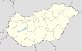
Keléd est un village de Hongrie, situé dans le département de Vas. Lors du recensement de 2008, il y avait 76 habitants.
Wikimedia Foundation.
2010.
Contenu soumis à la licence CC-BY-SA. Source : Article Keléd de Wikipédia en français (auteurs)
Regardez d'autres dictionnaires:
Keléd — is a village in Vas county, Hungary … Wikipedia
i-keled — ME. pa. pple. of kele v. to cool … Useful english dictionary
Stephen V of Hungary — Stephen V ( hu. V. István, hr. Stjepan VI., sk. Štefan V) (before October 18 1239, Buda, Hungary ndash; August 6 1272, Csepel Island, Hungary), King of Hungary and Croatia (1246 1272), and Duke of Styria (1258 1260). Early yearsHe was the elder… … Wikipedia
Ladislaus IV of Hungary — Ladislaus IV the Cuman ( hu. IV. (Kun) László, hr. Ladislav III., sk. Ladislav IV) (August 1262 ndash; July 10, 1290, Kőrösszeg, Hungary), also known as László IV, King of Hungary and Croatia (1272–1290).Early yearsHe was the elder son of Stephen … Wikipedia
Gutkeled — The Gutkeled (spelling variants: Gut Keled, Guthkeled, Guth Keled) was a family or clan (Latin ) of Hungarian nobles, to which a number of Hungarian noble families owe their ancestry.The primary source of their origins is the Gesta Hungarorum of… … Wikipedia
Gutkeled — Wappen der Gutkeled Die Gutkeled (Varianten: Gut Keled, Guthkeled, Guth Keled) waren eine Familie oder ein Clan (Latein generatio) des ungarischen Adels. Von ihnen stammen eine Reihe von ungarischen Adelsfamilien ab. Zu Beginn des 14.… … Deutsch Wikipedia
Vas County — Infobox Hungarian county name =Vas region =Western Transdanubia seat = Szombathely area = 3336 population = 261,900 density = 78 cities = 216Vas (German: Eisenburg , Slovenian Železna županija ) is the name of an administrative county (comitatus… … Wikipedia
Szentgotthárd — City centre with the Rába River … Wikipedia
Balkány — Infobox Settlement image caption = City settlement type = subdivision type = Country subdivision name = HUN latd= |latm= |lats= |latNS=N longd= |longm= |longs= |longEW=Epushpin pushpin label position = pushpin map caption = pushpin mapsize =… … Wikipedia
Mérk — Country Hungary County Szabolcs Szatmár Bereg Area Total 25.08 km2 (9.7� … Wikipedia
 Hongrie
