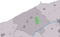
Hogebeintum
Contenu soumis à la licence CC-BY-SA. Source : Article Hogebeintum de Wikipédia en français (auteurs)
Regardez d'autres dictionnaires:
De Hogebeintumermolen, Hogebeintum — Origin Mill name Hogebeintumermolen Mill location Bij Mieddijk 6, 9173 GG Hogebeintum … Wikipedia
Kinderdijk — Coordinates: 51°53′N 4°38′E / 51.883°N 4.633°E / 51.883; 4.633 … Wikipedia
List of places in the Netherlands — This is an alphabetical list of places (cities, towns, villages) in the Netherlands. Lists per province can be found at:* List of towns in Groningen * List of towns in Friesland * List of towns in Drente * List of towns in Overijssel * List of… … Wikipedia
De Adriaan, Haarlem — Windmill De Adriaan De Adriaan is a windmill in the Netherlands that burnt down in 1932 and was rebuilt in 2002. The original windmill dates from 1779 and the mill has been a distinctive part of the skyline of Haarlem for centuries. Contents … Wikipedia
Artificial dwelling hill — An artificial dwelling hill (known as Terp, Wierde, Woerd, Warf, Warft, Werf, Wurt and Værft) is a mound, created to provide safe ground during high tide and river floods.These hills occur in the northern part of the Netherlands (in the provinces … Wikipedia
Hegebeintum — Infobox Settlement official name = Hegebeintum mapsize = 280px subdivision type = Country subdivision name = flagicon|Netherlands Netherlands subdivision type1 = Province subdivision name1 = flagicon|Friesland Friesland settlement type = Village… … Wikipedia
Ferwerderadiel — Gemeinde Ferwerderadiel Flagge Wappen Provinz Friesland … Deutsch Wikipedia
Hegebeintum — Warft mit Kirche Hegebeintum (niederl.: Hogebeintum) ist ein Dorf in der Gemeinde Ferwerderadiel, Provinz Friesland (Niederlande). Es hat ca. 120 Einwohner. Hegebeintum liegt auf der höchsten Warft (Terp) der Niederlande: 8,8 … Deutsch Wikipedia
Hegebeintum — 53°20′12″N 5°50′58″E / 53.33667, 5.84944 … Wikipédia en Français
De Achlumer Molen, Achlum — De Achlumer Molen De Achlumer Molen, May 2009 Origin Mill name De Achlumer Molen Mill location … Wikipedia

 Pays-Bas