Grand Portage (Minnesota)

Grand Portage (Minnesota)

47°57′50″N 89°41′05″O / 47.96389, -89.68472

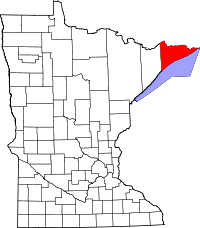
Localisation de Grand Portage dans l'État du Minnesota.

Grand Portage est un territoire inorganisé (Unorganized territory) reconnu comme tel par le Bureau du recensement des États-Unis, situé dans comté de Cook, dans l'État du Minnesota aux États-Unis.

Le territoire de Grand Portage a une superficie de 498,7 km² dont 192,2 km² de terre et 306,5 km² d'eau.

Grand Portage est situé le long de la rive du lac Supérieur.

Au recensement de l'an 2000, Grand Portage comptait 557 habitants, essentiellement des Amérindiens de la Nation Ojibwés.

Grand Portage est le lieu d'embarquement pour accéder à l'Isle Royale qui lui fait face et au Parc national d'Isle Royale.

La toponymie de Grand Portage indique un lieu important de transport de canoés. Ce nom lui fut donnée par les explorateurs français et les coureurs des bois et trappeurs canadiens-français à l'époque de la Nouvelle-France et de la Louisiane française.

En 1662, Pierre-Esprit Radisson et Médard Chouart des Groseilliers passèrent par là.

En 1722, un négociant français, Jean Pachot y fit référence.

En 1732, La Vérendrye reconnut ce lieu et en fit le passage obligé vers l'Ouest.

Lien externe


Wikimedia Foundation. 2010.

Contenu soumis à la licence CC-BY-SA. Source : Article Grand Portage (Minnesota) de Wikipédia en français (auteurs)

Игры ⚽ Нужно сделать НИР?

Regardez d'autres dictionnaires:

  • Grand Portage (Minnesota) — Grand Portage Territorio no organizado de los Estados Unidos …   Wikipedia Español

  • Grand Portage, Minnesota — Grand Portage is an unorganized territory in Cook County, Minnesota, on Lake Superior, at the northeast corner of the state near the border with northwestern Ontario. The population was 557 at the 2000 census. The town of Grand Portage lies… …   Wikipedia

  • Grand Portage National Monument — Infobox protected area | name = Grand Portage National Monument iucn category = III caption = locator x = 173 locator y = 23 location = Cook County, Minnesota, USA nearest city = Duluth, MN lat degrees = 47 lat minutes = 57 lat seconds = 44 lat… …   Wikipedia

  • Grand Portage National Monument — Monument national de Grand Portage Monument national du Grand Portage Catégorie III de la CMAP (Monument naturel) …   Wikipédia en Français

  • Grand Portage — Typische Waldlandschaft an der Küste des Oberen See 47.967222222222 89.681944444444 Koordinaten …   Deutsch Wikipedia

  • Grand Portage Indian Reservation — The Grand Portage Indian Reservation is located in Cook County near the tip of Minnesota s Arrowhead Region in the extreme northeast part of the state. The community was considered part of the Lake Superior Band of Chippewa, but is not a party to …   Wikipedia

  • Grand Marais, Minnesota — Infobox Settlement official name = Grand Marais, Minnesota settlement type = City nickname = motto = imagesize = image caption = image imagesize = image caption = image mapsize = 250x200px map caption = Location of Grand Marais, Minnesota… …   Wikipedia

  • Grand Portage National Monument — Der rekonstruierte Stützpunkt am Seeufer …   Deutsch Wikipedia

  • Grand Portage State Park — Geobox|Protected area name = Grand Portage State Park category = Minnesota State Park category iucn = V image caption = convert|120|ft|m|sing=on waterfall on the Pigeon River is the tallest in Minnesota. country = United States country state =… …   Wikipedia

  • Grand Portage National Monument — Historic site, northeastern corner of Minnesota, U.S. Located on Lake Superior near the Canadian border, it was designated a national historic site in 1951 and a national monument in 1958. It covers a 9 mi (14 km) overland trail from Lake… …   Universalium

Share the article and excerpts

Direct link
Do a right-click on the link above
and select “Copy Link”