Grand Cay
- Grand Cay
-
Grand Cay est une île des Bahamas située à l'extrême nord de l'archipel des îles Abacos. On compterait environ 450 habitants sur l'île.
L'île de Grand Cay fut l'endroit où le président américan Nixon pris sa retraite.
District
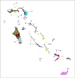
Grand Cay est l'un des 32 districts des Bahamas. Il est composé de l'île de Grand Cay ainsi que d'îlots alentours et porte le numéro 13 sur la carte.
Sources
Wikimedia Foundation.
2010.
Contenu soumis à la licence CC-BY-SA. Source : Article Grand Cay de Wikipédia en français (auteurs)
Regardez d'autres dictionnaires:
Grand Cay — is one of the districts of the Bahamas, in the Abaco islands. =External links … Wikipedia
Grand Cay — Admin ASC 1 Code Orig. name Grand Cay Country and Admin Code BS.42 BS … World countries Adminstrative division ASC I-II
Grand Cayman — Grand′ Cay′man n. geg the largest of the Cayman Islands, West Indies. 8932; 76 sq. mi. (197 sq. km) … From formal English to slang
Grand Turk Island — Grand Turk Strand von Grand Turk Gewässer Atlantischer Ozean Inselgruppe … Deutsch Wikipedia
Grand Bahama — Géographie Pays Bahamas Archipel Bahamas Localisation … Wikipédia en Français
Grand Turk — Géographie Pays Royaume Uni Archipel Îles Turques et Caïques … Wikipédia en Français
Grand Caicos — Middle Caicos (Grand Caicos) Position der Insel Gewässer Atlantischer Ozean Inselgruppe … Deutsch Wikipedia
Grand Bahama — Vorlage:Infobox Insel/Wartung/Höhe fehlt Grand Bahama NASA Bild von Grand Bahama Gewässer Atlantik … Deutsch Wikipedia
Grand Fleet — Infobox Military Unit unit name=Grand Fleet caption=Grand Fleet battleships dates=1914 1918 country=UK allegiance=British Empire branch=Royal Navy type=Naval Fleet role= size=151 ships command structure= current commander= garrison= ceremonial… … Wikipedia
Grand Turk Island — Infobox Islands name = Grand Turk image caption = A view of the southwestern beach at Grand Turk. This is currently the cruise ship dock, all of the other beaches are serene and very unpopulated image size = locator map custom = no native name =… … Wikipedia
 Bahamas
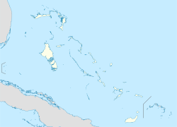
 Grand Cay