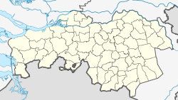
Gemert-Bakel
Contenu soumis à la licence CC-BY-SA. Source : Article Gemert-Bakel de Wikipédia en français (auteurs)
Regardez d'autres dictionnaires:
Gemert-bakel — Gemert Bakel … Wikipédia en Français
Gemert-Bakel — Gemeinde Gemert Bakel Flagge Wappen Provinz Nordbrabant Bürgermeiste … Deutsch Wikipedia
Gemert-Bakel — Infobox Settlement official name = Gemert Bakel mapsize = 280px subdivision type = Country subdivision name = Netherlands subdivision type1 = Province subdivision name1 = North Brabant area footnotes = (2006) area total km2 = 123.36 area land km2 … Wikipedia
Hoeven (Gemert-Bakel) — Hoeven is a hamlet in the Dutch province of North Brabant. (Not to be confused with the town Hoeven in the municipality of Halderberge.) It is located in the municipality of Gemert Bakel, about 1 km southeast of the town of Milheeze. ANWB… … Wikipedia
Gemeente Gemert-Bakel — Admin ASC 2 Code Orig. name Gemeente Gemert Bakel Country and Admin Code NL.06.1652 NL … World countries Adminstrative division ASC I-II
Bakel — ist ein anderes Wort für Rohrstock, eine Stadt in Senegal: siehe Bakel (Senegal), ein Ortsteil der Gemeinde Gemert Bakel in den Niederlanden, siehe Gemert Bakel. Siehe auch: Wiktionary: Bakel – Bedeutungserklärungen, Wortherkunft,… … Deutsch Wikipedia
Gemert — is a village in the Dutch province of North Brabant. It is located in the municipality of Gemert Bakel.Gemert was a separate municipality until 1997, when it merged with Bakel. [Ad van der Meer and Onno Boonstra, Repertorium van Nederlandse… … Wikipedia
Bakel en Milheeze — is a former municipality in the Dutch province of North Brabant. It consisted of the villages Bakel and Milheeze, and has been a part of the municipality of Gemert Bakel since 1997.External links* [http://www.kuijsten.de/atlas/nb/bakel.html Map… … Wikipedia
Gemert — 51°33′21″N 5°41′12″E / 51.55583, 5.68667 … Wikipédia en Français
Bakel (Brabant-Septentrional) — 51°30′9″N 5°44′27″E / 51.5025, 5.74083 … Wikipédia en Français


 Pays-Bas


